How Israel reshaped refugee camps in the northern West Bank

3 min read

CIR

CIR 's photo

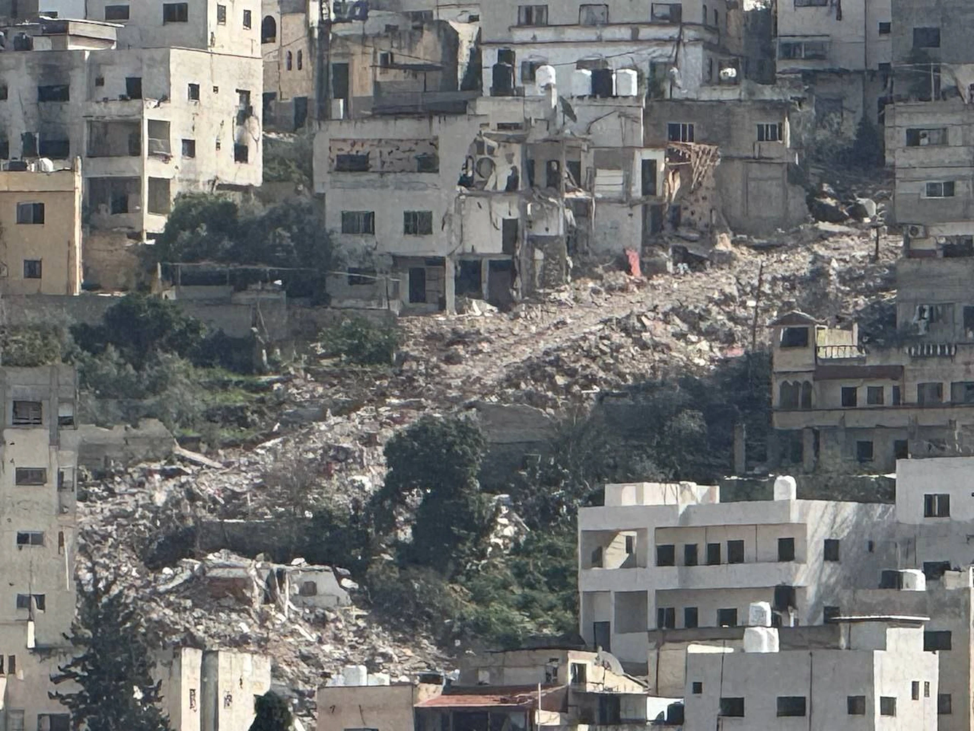
Image showing road clearance in the al-Jabryat neighbourhood of Jenin. Source: Quds News Network

Download Report

Share Report

Over the past year, footage of Israeli armoured vehicles, bulldozers and raids inside the Jenin, Nour Shams, Tulkarm and al-Fara’a refugee camps has surfaced regularly on social media. Much of it captures Operation “Iron Wall”, the large-scale military operation Israel launched in Jenin on 21 January 2025 and soon expanded across the northern West Bank. The Israel Defence Forces (IDF) claimed the operation targeted militant infrastructure and buildings it said were needed to clear routes for its troops. The UN, however, has described it as the longest and most destructive operation in the West Bank since the second intifada. It estimates that over 32,000 people have been displaced, many of whom remain unable to return home.

In May 2026, Israeli authorities issued an order to seize land in the al-Jabryat area of Jenin to build a military base, reported to be the first land seizure inside a West Bank city since the Oslo Accords. 

CIR tracked IDF activity across all four camps between December 2024 and March 2025, documenting changes both before and after Operation Iron Wall began. Investigators have verified and geolocated 17 case studies of possible forward operating bases, checkpoints, clearances, and damage to homes and roads.
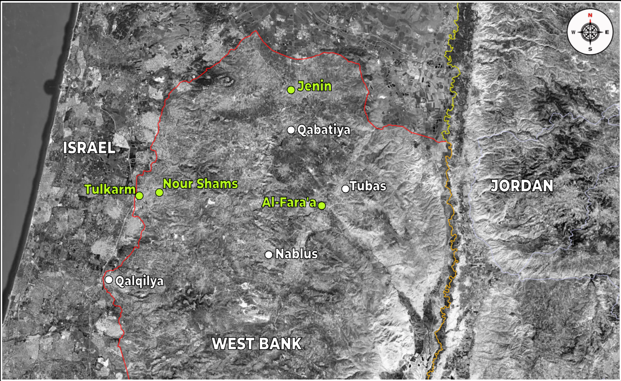
Location of Jenin, Nour Shams, al-Fara’a and Tulkarm in northern West Bank. Source: Google Earth.

Carving roads through Jenin

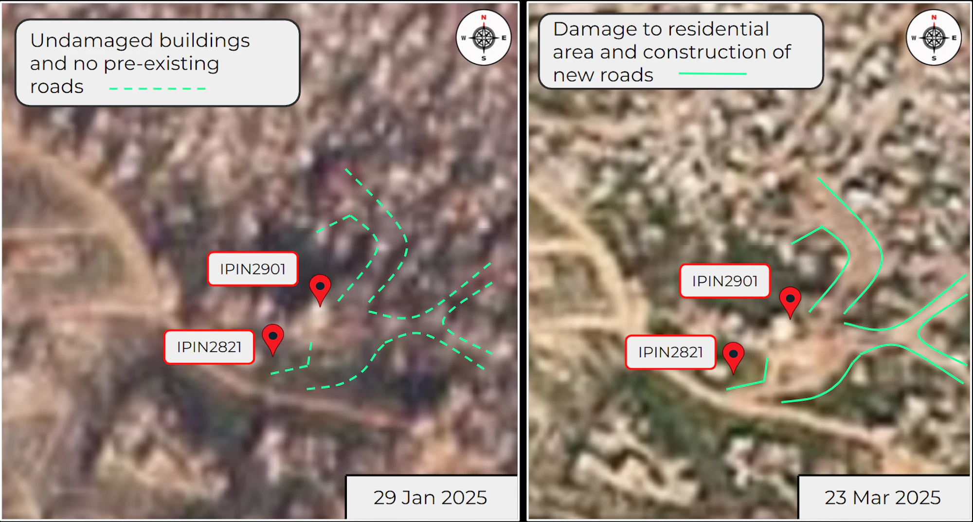
The significant road clearances, checkpoints and occupation of homes visible today in the camps began in the operation’s first weeks. One case study centred on al-Jabryat, the Jenin neighbourhood later targeted by the May 2026 seizure order. CIR verified footage shared on 12 February 2025 showing bulldozers and armoured vehicles cutting a new road through the camp along Mahyoub Street, with residential buildings demolished to make way for it. A comparison of Planet Labs imagery from 29 January and 23 March 2025 shows the clearance and widening of roads, though CIR could not independently establish the exact date the damage occurred.

Satellite imagery of Mahyoub Street, Jenin from 29 January 2025 and 23 March 2025. Source: Planet Labs.

Repeated military presence in Kherbet as-Soha

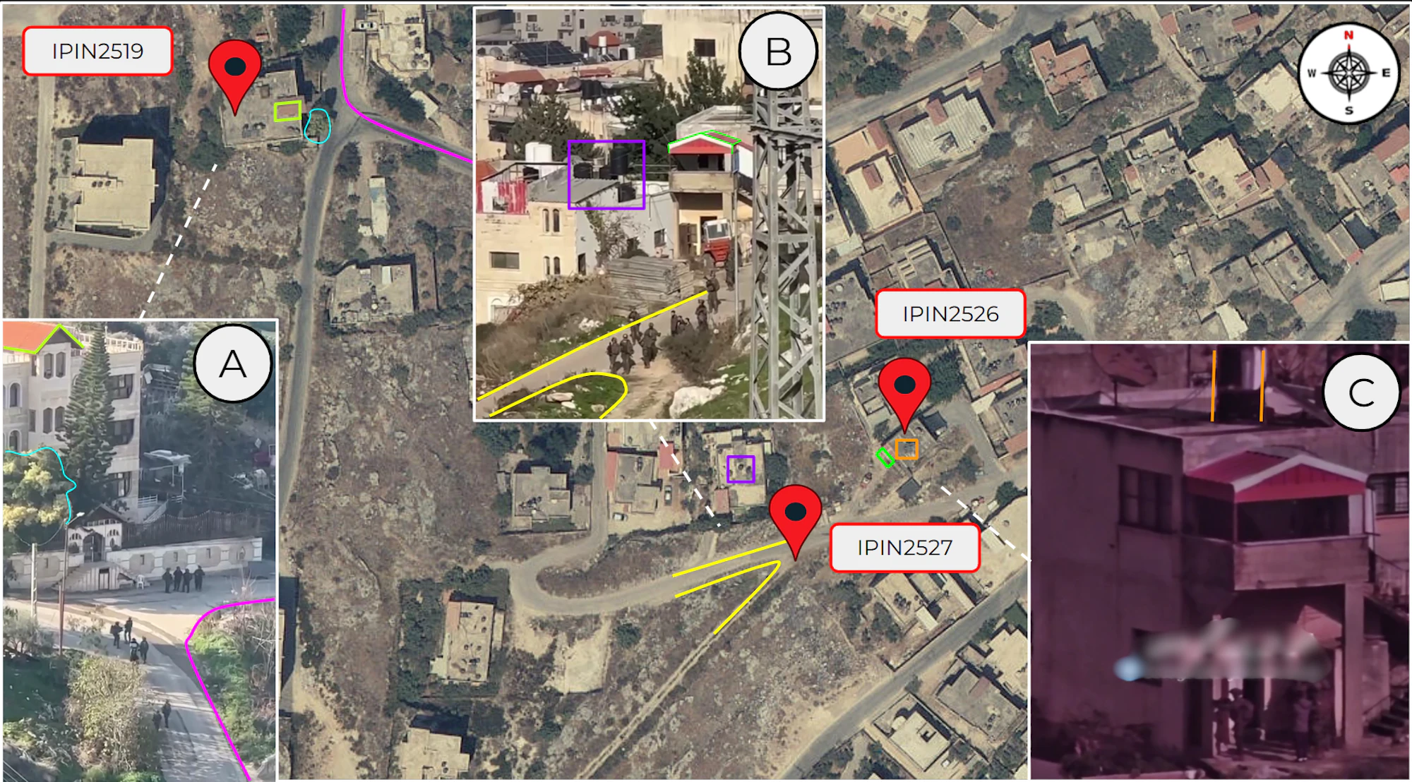
In the nearby Kherbet as-Soha area, CIR documented a repeated IDF presence at the same residential building on al-Madina al-Munawara Street across separate incidents in January 2025. Footage from 24 January 2025 shows soldiers escorting several people in plain clothes, some with their hands held behind their backs, towards that building, where military vehicles and an earlier casualty had already been reported. The clustering of these incidents at a single location led CIR to assess it as a possible detention site. That day, the IDF said its forces had arrested around 20 wanted individuals in Jenin, and local reports described a large-scale detention campaign across the camp, though CIR could not independently verify this.

CIR geolocated IDF military presence at multiple residential buildings on two separate dates in the Kherbet as-Soha residential area, Jenin at coordinates: 32.4561, 35.2916, 32.4554, 35.2931 and 32.4552, 35.2929. Sources: GovMap, A: IP10152, B: IP10181 and C: IP10183.

A pattern across four camps

The incidents documented in Jenin formed part of a broader pattern that CIR identified across all four refugee camps of the IDF systematically repurposing the urban landscape. Rather than constructing new infrastructure or defensive barriers such as T-walls, forces occupied existing civilian homes as command positions, establishing checkpoints, and clearing routes for armoured vehicles. 

Drawn from 17 verified case studies and continuous monitoring that began in December 2024, CIR’s findings documented these changes before much of the destruction now visible across the camps had occurred. The subsequent expansion of road clearances and the May 2026 land seizure in al-Jabryat are consistent with the trajectory identified during the investigation. Read the full report for CIR’s complete findings and methodology. 

Share Report