

Air Attacks in Myanmar since 2025 Earthquake
This map shows the air attacks allegedly carried out by the Myanmar Air Force (MAF) between the earthquake on 28 March 2025 until 10 days later 7 April 2025, as documented by Myanmar Witness. The attacks were reportedly conducted using aircrafts, drones, and paramotors. Additional data will be added as they are documented.
Israel-Gaza Conflict Map
The Israel-Gaza Conflict Map is a map of incidents documented by CIR covering the Occupied Palestinian Territories (the Gaza Strip, the West Bank, and East Jerusalem), Israel, and Lebanon since 7 October 2023.
Incidents have been visually verified using videos and photos uploaded from the ground, as well as satellite imagery, to identify when the incident happened (date) and where it happened (location). Each piece of data has been analysed for authenticity by CIR Investigators.

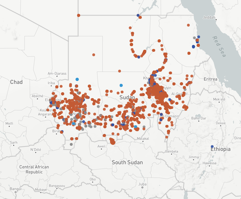
Fire Map
Map with fire events in Sudan since 15 April 2023. Each point on the map represents a fire event: a fire that happened on a specific day, or several consecutive days, in a specific area.

Rare Earth Mining Map
This is a map showing rare earth mining sites in Myanmar. Myanmar Witness and Mizzima worked together on the project to identify the sites using satellite imagery from Google Earth and Planet. The map also shows when each site was formed and how many pits there are at each site. The darker the colour of the marker, the more pits were drilled at that particular site. The time period was calculated using Google Earth satellite imagery.

Eyes on Russia Map
The Eyes on Russia Map was created to facilitate the public's access and understanding of this information. Developed in collaboration with C4ADS
Sudan Shahid
The Sudan Shahid map is a collaborative effort between the Centre for Information Resilience, C4ADS and the Sudan Human Rights Hub to monitor the violence in Sudan documented by our teams and partners.

Operation 1027 Map
On 27 October 2023, a military coalition called the Three Brotherhood Alliance launched an offensive against the Myanmar military. This ongoing offensive is being referred to as “Operation 1027”.

Arms Brokers
Use the map to explore which companies have brokered arms & equipment for the Myanmar military. Created by @BenDoBrown from @MyanmarWitness with data from @JusticeMyanmar.

Map of MAF Airbases in Myanmar
Myanmar Witness has documented an increasing number of airstrikes in Myanmar since the coup.

Map of Fires in Myanmar (01 Sep 2021 - Present)
Myanmar Witness uses satellite imagery, verified footage and NASA FIRMS data to document and investigate where buildings and villages have been destroyed by fire in possible human rights incidents.

Timeline Map
The map draws on the database of videos, photos, satellite imagery or other media related to the situation in Afghanistan following the takeover by the de facto Taliban authorities