Tracing the damage and civilian impact of an airstrike in Kyauktaw

2 min read
Myanmar Witness

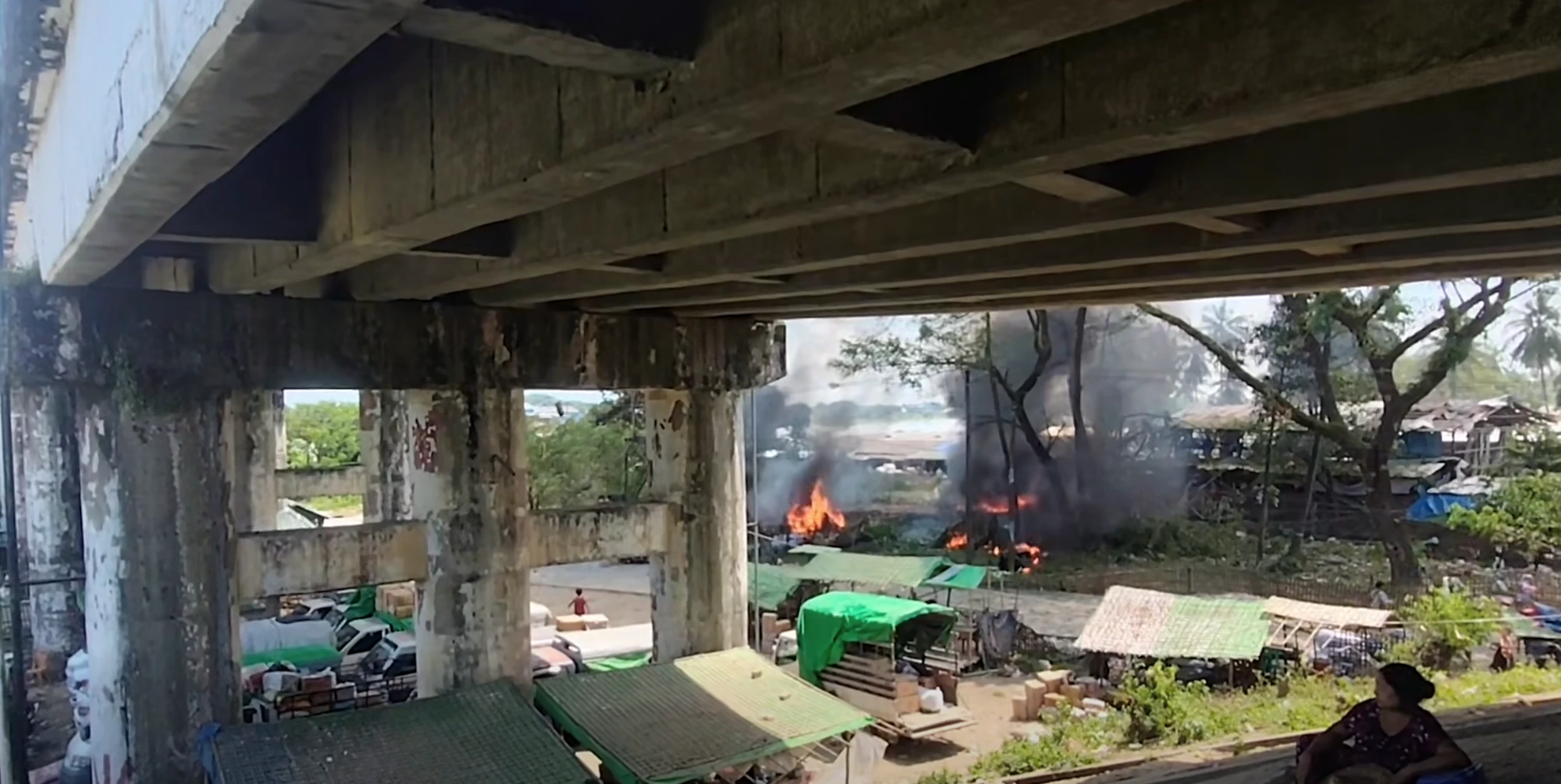
Screenshot from a video shared by a social media user showing the impact of the first reported airstrike in Kyauktaw, followed shortly by a second strike.
Myanmar Witness geolocated incident-related user-generated content (UGC) to approximately [20.833724, 92.984405], near Kissapanadi Bridge and India Market. Available online material shows large explosions at the bridge, aircraft-consistent audio, craters, heavy-impact damage, fire damage, and casualties. Additionally, historical satellite imagery highlights the area as a busy commercial and transport location.
Myanmar Witness assesses with low confidence that an aerial image, which was published by the AA Info Desk, if captured at the geolocated location on 28 September 2026, was recorded between approximately 12:42 and 13:22 local time. This estimation is later than the initial 12:10-12:14 local time reported for the reported strikes, and it still does not independently confirm the incident date or exact time. Additionally, the footage analysed also displays a timestamp of 2026-09-29 01:15:32, but its time zone and provenance are unknown; therefore, Myanmar Witness could not use it to establish its recording time.
The Arakan Army (AA), Development Media Group (DMG) and other local media outlets have attributed the incident to the Myanmar Air Force (MAF). The AA alleged that a fighter jet dropped two bombs in the vicinity of the market. Myanmar Witness has not verified the aircraft, munitions, flight route or the identity of the actor responsible. However, it is important to note that the MAF are the only known entity to have the capability of conducting an airstrike of this scale.
Myanmar Witness’s forensic analysis of the available footage identified strong visual indicators consistent with at least 33 deceased individuals. Note, this is a minimum visual estimate, not a confirmed death toll. The AA and local aid workers have reported approximately 50 deaths and close to 60 injuries; investigators could not verify those overall figures.
During that time, Myanmar Witness has also documented 14 alleged airstrikes across Myanmar between 28 September and 1 October 2026, including the reported Kyauktaw incident. These reports may indicate broader aerial activity; however, they do not establish coordination or a connection between the incidents.
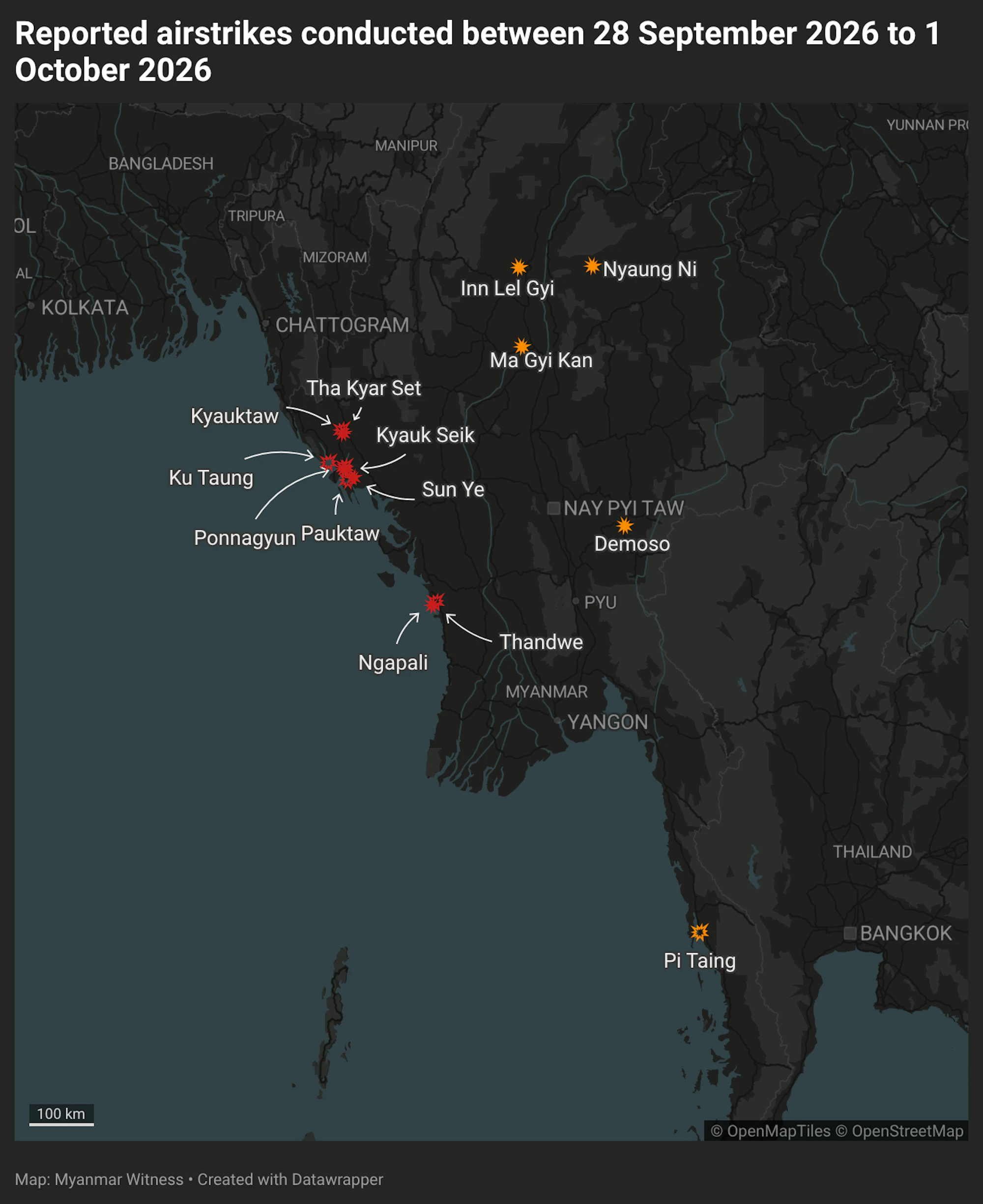
Myanmar Witness documented reported airstrikes between 28 September and 1 October 2026, including the Kyauktaw incident. The map details 14 alleged airstrikes; locations highlighted in red are in Rakhine State.
Download our report to read our findings in full.