Summary:
Myanmar Witness was able to geolocate footage showing a number of burnt bodies to a site just outside Thit Sein Gyi village (22.423056, 95.949964). Sentinel-2 satellite imagery of the site confirms that there were burn marks in the alleged location, acquired during the period when the military reportedly occupied the area. Sentinel-2 imagery shows no burn scars on January 30, but does show burn scars on February 4, indicating the burning happened at some point in between those two dates.
Detail:
Burmese media (including Mizzima, Irrawaddy and RFA) reported that soldiers alleged to be from the Myanmar Army’s Sagaing Division entered Thit Sein Gyi village (သစ်ဆိမ့်ကြီး) in Wetlet Township at about 2am on January 29 2022 and arrested six villagers. The residents were claimed to have been used as human shields and subsequently killed. The events were reported after the military were claimed to have left the area on the morning of February 4.
Reporting from RFA, based on interviews with local residents, claims that the victims were all male, and that they were “handcuffed and burned”. Through interviews with local residents, The Irrawaddy identified the victims as Myint Aung (58-years-old) The Tun Aung (28), Ko Ko Lin Maung (28), Thura Tun (20), Zaw Min Tun (43) and Min Min Tun (35).
Myanmar Witness has collected evidence from social media showing what appears to be the site of where the bodies were burned. The original post can be seen on the Foundie Foundie Foundie news-site here. In the footage, a peak of a pagoda can be seen in the background, enabling Myanmar Witness to geo-locate this site. (Figure 1)
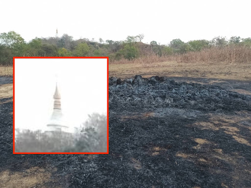
Figure 1: Pagoda in the background of footage
We were able to cross-reference with old footage uploaded by Mizzima TV, to match the peak of the pagoda to another pagoda in the area (Figure 2).
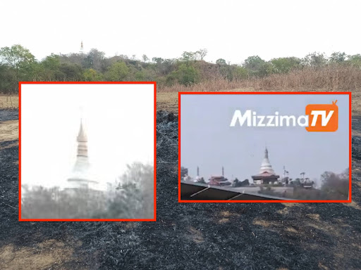
Figure 2: Cross-referencing of the pagoda with Mizzima TV images
The pagoda seen in the above images can be located to the outskirts of Thit Seint Gyi, at coordinates: 22.421225, 95.951197. Features seen in those images match what is seen on satellite imagery at that location (Figure 3).
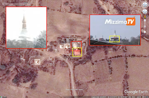
Figure 3: Geolocation of pagoda using satellite imagery
By using Sentinel-2 satellite imagery, Myanmar Witness has been able to identify burn scars where fire has ‘charred’ the land, indicating a likely location of where the bodies were burned near the geolocated pagoda. The verification of that burn scar can be seen below in the imagery from January 30, 2022 (Figure 4) and February 4, 2022 (Figure 5).
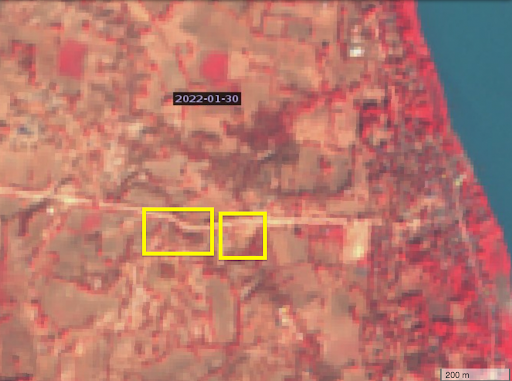
Figure 4: Satellite imagery of the location from 30 January 2022
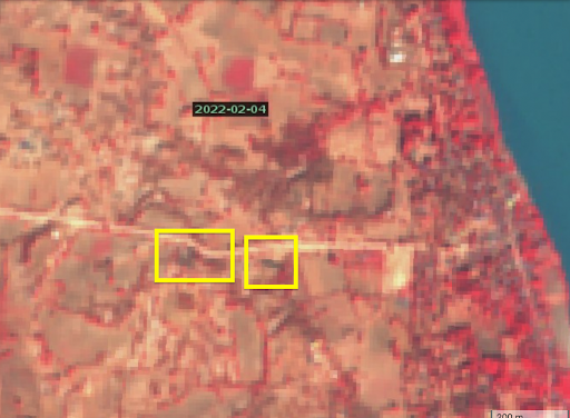
Figure 5: Satellite imagery of the location from February 4, 2022
The location of that burn scar was in a field about 250m northwest of the pagoda, as seen in Figure 6 below.
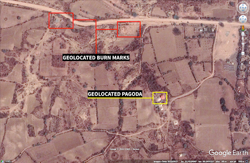
Figure 6: Location of burn scar in relation to the pagoda
The second burn scar, more to the west of the field, was at a small collection of sheds on the side of the road. Images taken from the location of those sheds (seen here and here – graphic) shows that those buildings were destroyed by fire damage.
For the purpose of verification, those buildings match those seen on satellite imagery below, with both the green and purple structures matching the features at that location (Figure 7).
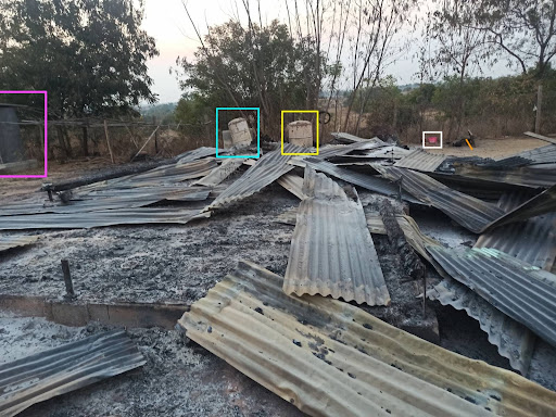
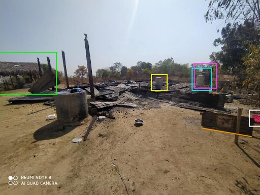
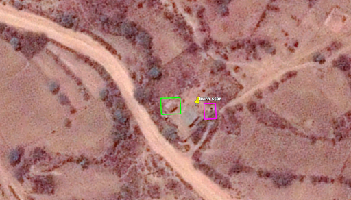
Figure 7: Geolocation of burnt sheds
Further images identified by Myanmar Witness that were uploaded to social media by a private user show what appears to be bones in burnt areas alleged to be near the village. This report will not link to that social media account, however the originals will be made available upon request.
While the whole image is too graphic to show, the image does display specific features in the background that allow for geolocation, such as the pagoda that is visible in the background of the below image.

Figure 8: Image uploaded to social media on February 4, 2022 (cropping by Myanmar Witness).
This pagoda is seen here on Google Maps images and can be geolocated to this location about 500m away from where the burnt areas have been identified.
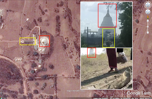
Figure9: Geolocation of image uploaded to social media on February 4, 2022.


