The Centre for Information Resilience’s Eyes on Russia (EoR) is an open source investigations project to map, document and verify significant incidents during the conflict in Ukraine. Our aim is to provide reliable information on the conflict through verified open source evidence. The lead resource of the Eyes on Russia project is the Russia-Ukraine Monitor Map. This investigation is a result of that work.
This report identifies attempts by Russian state-representatives, embassies, consulates and so-called ‘fact checkers’ to raise doubt and discredit footage of bodies seen on the streets of Ukraine’s Bucha (Буча) in early April, as well as to discredit the satellite imagery that corroborates the evidence seen in the footage.
The findings of this report identify and counter claims made by Russian Government representatives and a ‘fact checking’ site, WarOnFakes. We reveal critical flaws in the arguments used to discredit the open source evidence available on the identification of corpses in Bucha during Russia’s occupation of the city.
The evidence used in this report includes two independent satellite images showing bodies on the ground on Bucha’s Yablunska Street, comparison analysis of shadows, as well as multiple angles of footage confirming the veracity of the open source evidence.
This evidence, specifically the satellite imagery obtained through independent organisations, indicates that the bodies of Ukrainian victims appeared on Yablunska Street on March 19 during Russia’s occupation of Bucha and a coordinated effort by the Russian Government to amplify and discredit any evidence of what happened.
What happened in Bucha?
After occupying areas around Kyiv in an attempt to besiege Ukraine’s capital, Russia’s defence ministry announced that they would “radically reduce military activity in Kyiv and Chernihiv regions” on March 29. After the announcement, Russian forces left the Ukrainian city of Bucha, just over one hours drive northwest from Kyiv’s city centre. After their withdrawal, grim images and reports started to emerge of numerous bodies lying dead on the streets, some with hands bound, some shot.
International media gained access to Bucha and the surrounding areas to investigate after the withdrawal. The BBC, Al Jazeera, the Guardian and others were able to visually and independently verify the distressing evidence: there were indeed bodies on Bucha’s streets.
Further reporting from international media on the ground identified mass graves and horror stories that have seen calls for investigations into potential war crimes committed in the town during the occupation.
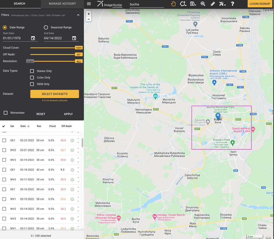
Our team at EoR has mapped numerous pieces of footage and photos logged by locals, government and media on the Russia-Ukraine Monitor Map in Bucha, as seen below.
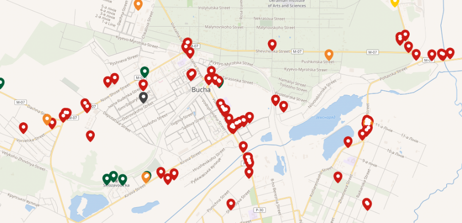
Alternative angles of the bodies identified in Bucha can be seen in the verified footage included in the map. Much of this content was verified as having been taken, or filmed, in Yablunska and Vokzalna Streets
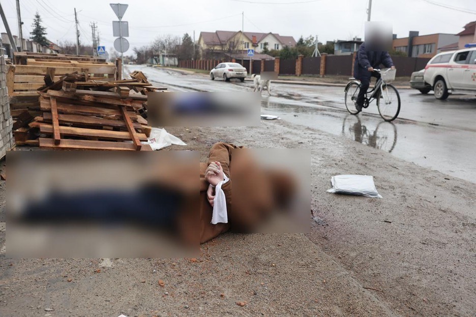
While the footage is difficult to look at, given its graphic nature, the state of the bodies seen on those streets indicated that they had been there for some time, and that they had been killed in what is potentially an inhumane manner.
For example, the image below of one of the bodies shows hands clearly bound behind their back. This image was geolocated by our team to these coordinates: 50.542305, 30.231671. Video footage of the same scene can also be viewed here.
Satellite imagery analysis of Bucha’s Yablunska Street
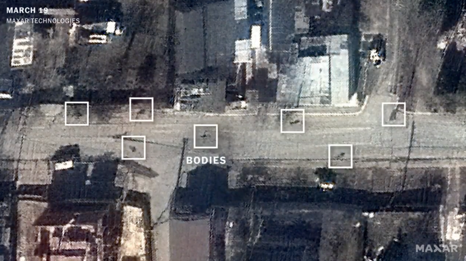
One of the scenes that attracted considerable international attention was footage of bodies along the sides of Yablunska Street. The footage is graphic, and can be seen posted by Ukrainian Defence here.
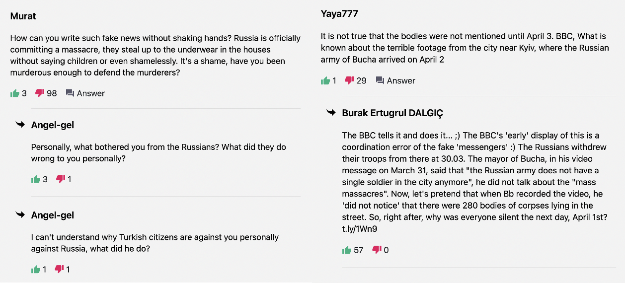
Despite the multiple sources of footage, the Russian Government claimed the “photos and video footage from Bucha are another hoax, a staged production and provocation by the Kiev regime”.
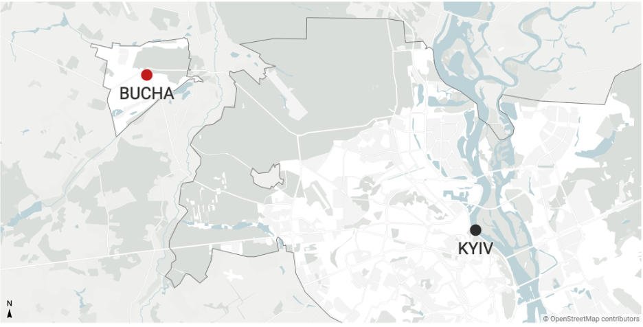
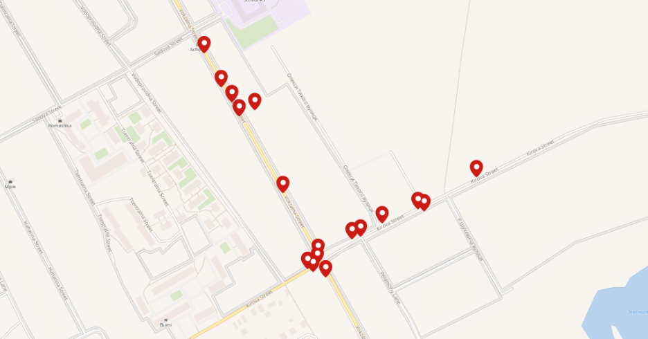
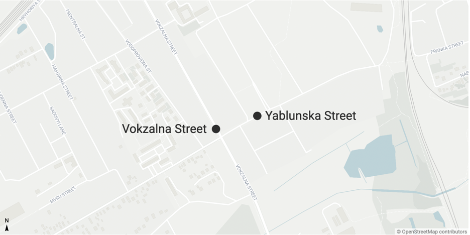
Analysing the locations of the photos and videos indicates most of the bodies shown were located on Yablunska Street, which runs along a new development area, and crosses Vokzalna Street.
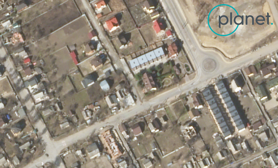
The locations of the two streets can be seen below.
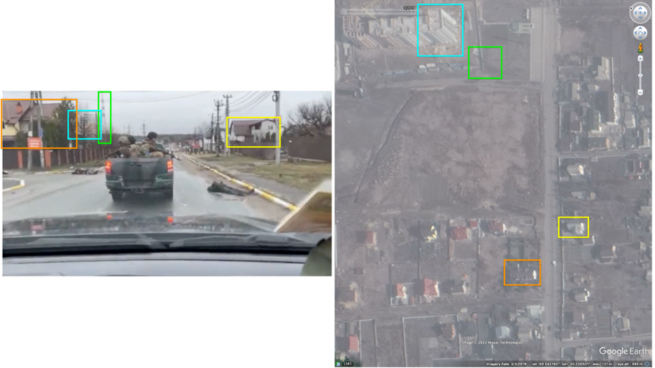
The footage showing the bodies on Yablunska Street fits the location precisely by using geolocation to confirm buildings, towers and rooftops, as seen below. The footage filmed from the interior of the vehicle shows the cars moving northeast along Yablunska Street, crossing over these coordinates: 50.541996, 30.230549.
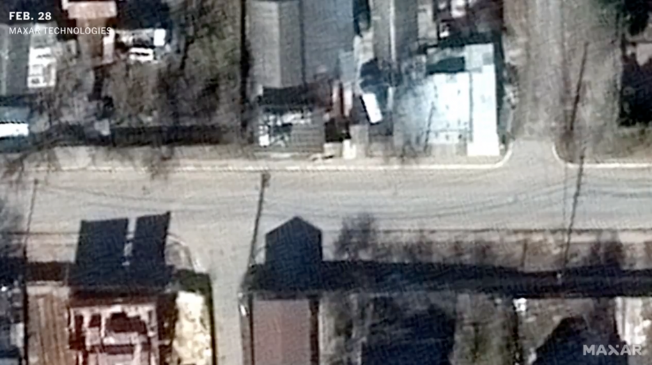
This footage was used by New York Times to cross reference what is being seen in the video, to what is seen on satellite imagery provided by Maxar dated March 19, 2022.
This satellite imagery has been the target of numerous attempts by the Russian Government to discredit its validity. These claims are addressed and dismissed in a later section of this report.
The two images below, the first one being from February 28, and the second being from March 19, shows what appears to be bodies that match the exact same locations as those seen in the video. These screenshots were published by New York Times in their verification of Bucha.
The Centre for Information Resilience obtained satellite imagery from Planet, dated March 21, 2022, that also shows patterns indicating the locations of the bodies as being in the same position as they were in the Maxar satellite imagery seen above.
Analysis of the location, and geolocation of the footage filmed on Yablunska Street, indicates signs of the bodies seen in the imagery.
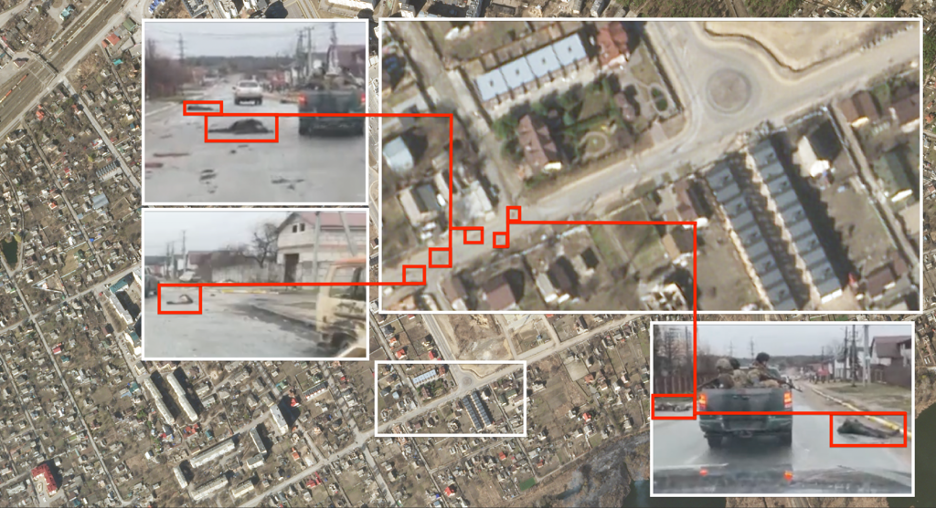
The use of two independent sources of satellite imagery indicates that the bodies were present in the exact same locations on Bucha’s Yablunska Street as seen in the imagery from Maxar on March 19, and the imagery from Planet on March 21.
Both satellite images were taken before March 29, when Russian forces withdrew from the area. This clearly indicates that the bodies appeared on Bucha’s streets during the Russian occupation of the city.
Analysis of disinformation and ‘doubt raising’
Given the significant media attention to both the footage from Bucha, as well as the satellite imagery posted by the New York Times, the Russian Government made numerous attempts to counter the information by attempting to either allege that the footage has been staged, the satellite imagery is wrong, or at the very least to raise doubt over the legitimacy of the sources.
It should be noted that this is not the first time the Russian Government has attempted to target specific events with denialist and blame shifting disinformation. Similar tactics were seen employed after the shooting down of MH17. A comprehensive disinformation timeline and analysis can be seen from EUvsDisinfo.
Similar tactics employed in Russia’s disinformation campaign on MH17 have been present in the campaign on Bucha, such as claiming the footage was staged to blame Russia, discrediting evidence due to ‘relationships with western governments’ and that the evidence was faked.
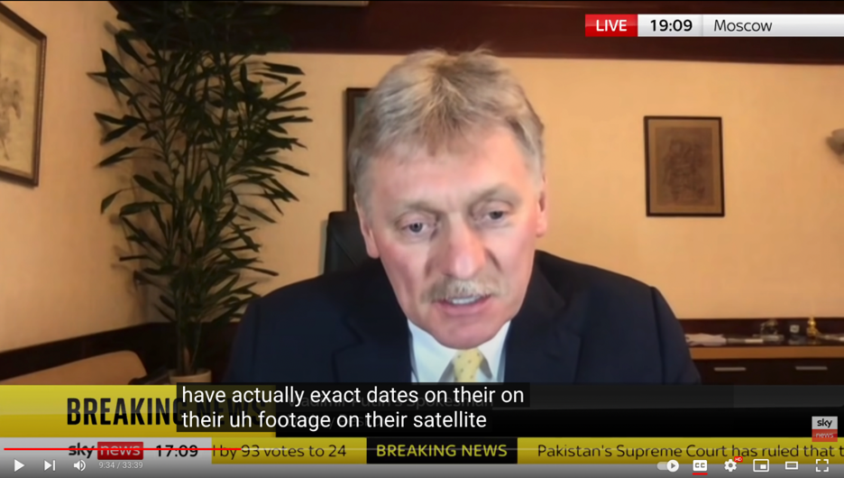
Instances of the Kremlin’s doubt raising and defence lines can be seen in this interview by Sky News with Dmitry Peskov, a spokesperson for Russian President Vladimir Putin, on April 7, 2022. In the interview, Peskov denied any evidence related to Bucha, and dismissed the satellite imagery – claiming that Maxar had a ‘close relationship with the Pentagon’ and that ‘they [Maxar] did not have dates on their satellite images’.
This attempt to discredit satellite imagery as a source in relation to potential human rights abuses in Bucha has been echoed numerous times. For example Aydınlık, a Turkish news outlet, claimed the satellite images were wrong dates due to both shadows in the imagery, and what they believed to be indications that the imagery was missing from Maxar archives. Any attempt in the comments section of that article to counter the claims are met with downvotes and negative comments.
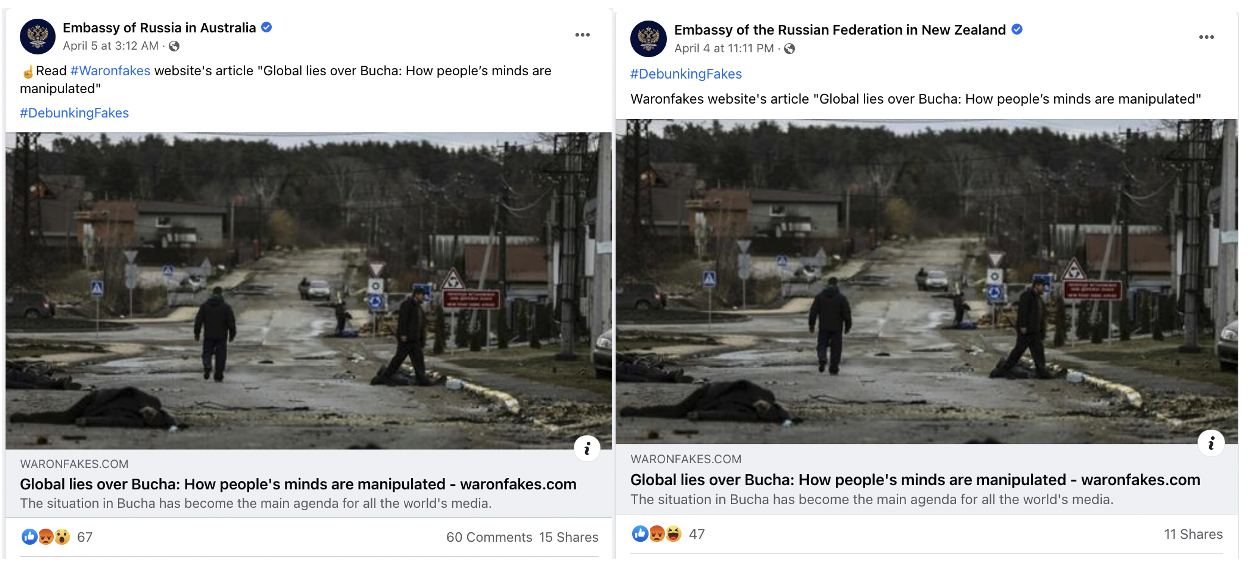
While there appears to be significant attempts online social media to counter and deny events in Bucha. Much of it appears to come from a ‘fact checking’ site titled WarOnFakes. This site has been known to promote pro-Russian content in its ‘debunking’ attempts of different events in Ukraine.
The WarOnFakes site has had significant amplification from the Russian Government, especially through its network of verified accounts on Facebook and Twitter.
For example here the Russian MFA promotes the site. The site, in specific to the Bucha context, has been shared by the Consulate General of Russia in Cape Town, Russia’s Embassy in New Zealand, Russia’s Embassy in Montenegro, Embassy of Russia in Australia and others.
The site addressed the satellite imagery in a piece titled Sputnik and Fakodrom. What is known about the situation in Bucha on 6.04?. In the piece, there are a number of specific attempts by WarOnFakes to discredit available satellite imagery from Bucha, namely that there was no imagery from March 19, and that shadows seen in the imagery do not match. These are wrong, as the analysis below shows.
Was there available satellite imagery from March 19?
WarOnFakes claimed that Maxar’s website does not display satellite imagery from March 19; as seen below, the site claimed that there was no imagery available when searching for it in Maxar’s archive at discover.digitalglobe.com.
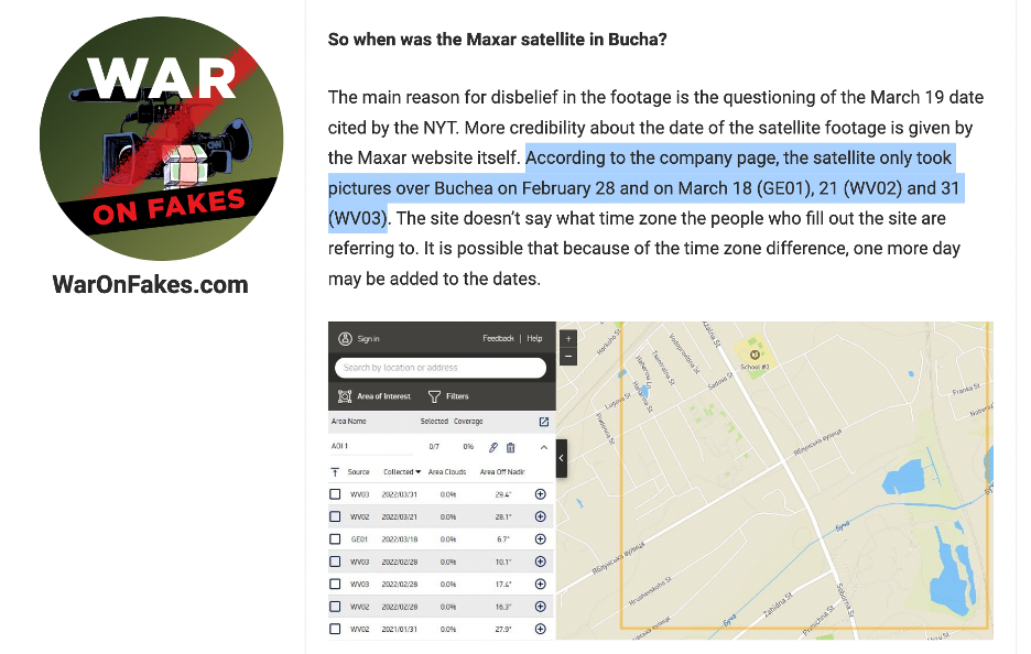
This claim is wrong. The reason why the screenshot does not show imagery from March 19 is that it has been filtered out of the search results due to the angle of the satellite imagery (the nadir). A simple change of the filters in the search gives the options below, which includes March 19 imagery.
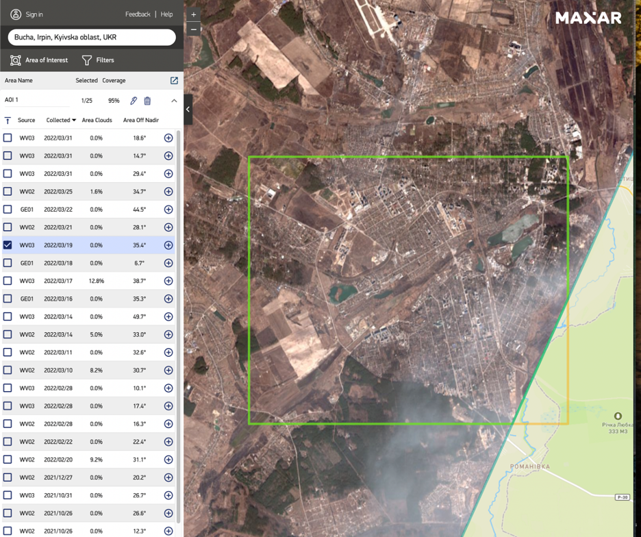
An independent satellite imagery purchase service, Apollo Mapping, also displays the correct content when searching for imagery over Bucha.
Specifically it shows Maxar’s March 19 imagery available, as seen in the screenshot below.
Do the shadows match the satellite imagery?
The report by WarOnFakes attempting to ‘debunk’ and discredit Maxar’s satellite imagery from Bucha also indicates that there was a discrepancy on the shadows in the satellite imagery.
The report references work done by Telegram account ‘Rybar’ (https://t.me/rybar/30591) as the origin of these findings.
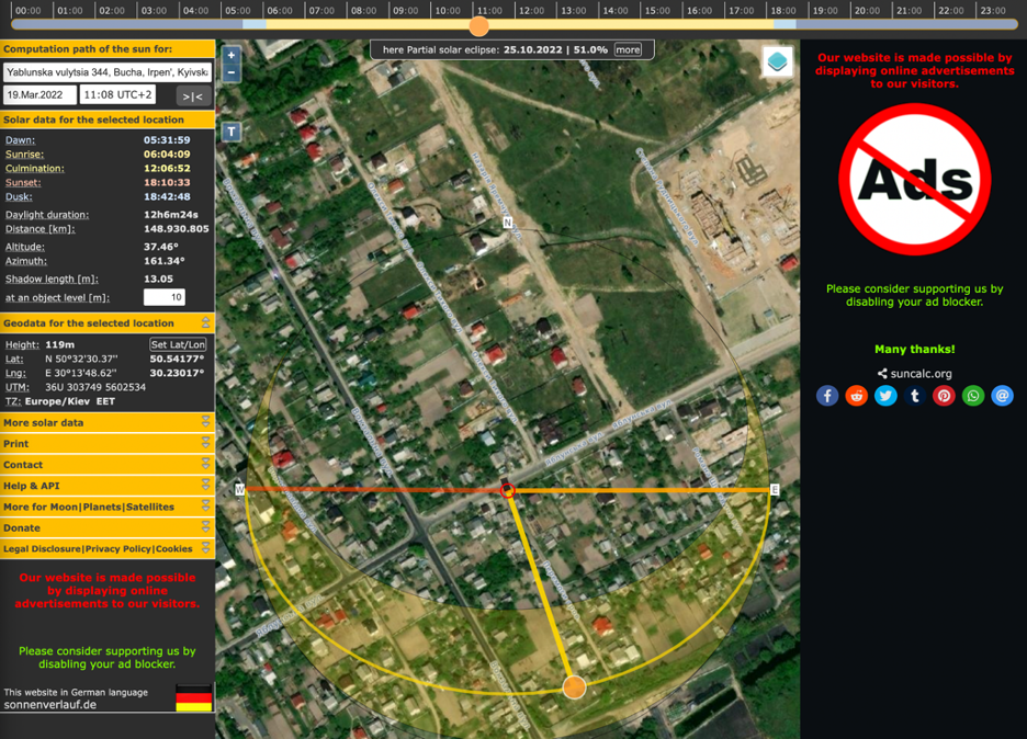
According to Apollo Mapping the acquisition time of Maxar’s March 19 satellite image was at 09:08:31 UTC.
On March 19, Ukraine’s Bucha was in the UTC+2 timezone. The specific time in Ukraine moved to UTC+3 on March 27, 2022.
Therefore the satellite image was taken at 11:08AM local time in Bucha, Ukraine.
Rybar’s claim was that the shadows seen in Maxar’s satellite imagery from March 19 could not have matched the timestamp of 09:00AM, as the shadows would have looked different at that time. However, this seems to be an error in converting the times, as Rybar was attempting to match shadows from a 09:00AM timestamp, and not an 11:08 timestamp.
The satellite imagery was taken at 11:08AM local time, or 11:08 UTC+2; a link to this reading can be seen on Suncalc at this link.
These findings can also be confirmed by matching the angles cast by the shadows in the satellite imagery.
By layering the imagery into Google Earth, we can obtain the angle at which the sunlight would have been coming from, which is in proportion with the angle of the shadow. The heading for the direction of the sun was 161 degrees in the image. The location of the post is 50.541771, 30.230175.
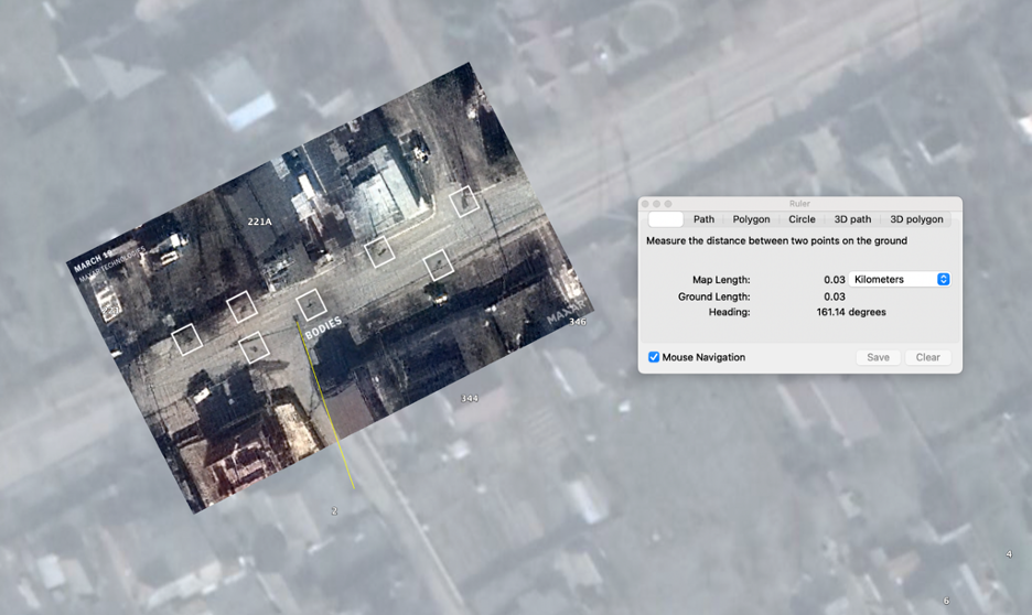
At exactly 11:08UTC+2 on March 19, 2022, which is when the satellite image was claimed to have been taken, the direction of sunlight was at 161 degrees – an extremely similar figure to that seen in the direction given from the reading on Google Earth. This indicates an accurate fit as to the time and date of the satellite image.
The link to the suncalc.org with the prefilled values as seen above can be seen here. A screenshot is included below to see these readings.