
By Guy Agam Fusfus and Benjamin den Braber. With contributions from Sofia Santos.
The Centre for Information Resilience’s (CIR) Eyes on Russia project is an open-source investigations project to map, document, and verify significant incidents during the ongoing conflict in Ukraine.
Our work aims to provide reliable information to journalists, policymakers and the public. The lead resource of the Eyes on Russia project is the Russia-Ukraine Monitor Map. This investigation is a result of that work.
The verification seen in this report will be logged in a central database where the material is archived for future use by researchers, reporters, as well as justice and accountability bodies.
Executive Summary
Eyes on Russia (EoR) investigators used footage uploaded to social media, as well as satellite imagery, to confirm reports of widescale destruction in Makariv.
EoR investigators have confirmed damage to more than 300 buildings: the town’s hospital, fire station, multiple education facilities and hundreds of houses and apartment buildings.
This report adds to the rapidly growing body of evidence indicating Russia is committing ongoing human rights abuses in its occupation of Ukraine.
Contrary to the Kremlin’s assertions, CIR has continuously documented the intentional targeting of Ukrainian civilians and civilian infrastructure. Verified incidents of civilian harm are held in a secure database; it is available for NGOs, journalists and accountability bodies to use.
These actions by Russia appear to constitute war crimes. CIR will continue to document civilian harm in Ukraine to help hold those responsible to account.
Introduction
Makariv (Макарів) is a town located in Kyiv Oblast, 50 kilometers to the west of Kyiv. The town is in proximity to highway E40 that leads into Kyiv, the capital, making it a crucial location for Russian forces.
Since the first days of the invasion, Russian activity was reported at the town and its surroundings.
On 22 March, the Ukrainian Ministry of Defence announced that Ukrainian forces liberated the town of Makariv after weeks of continuous clashes.
On 8 April, the Mayor of Makariv, Vadim Tokar, reported that up to 132 civilians were killed during the invasion. Tokar added that most of the city’s infrastructure was destroyed, including medical facilities.
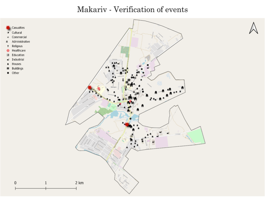
Figure 1: A map showing all verified incidents of civilian casualty and infrastructure damage in Makariv.
Casualties
● Shelling of a civilian car (Geolocated to 50.463860, 29.795898)
On 28 February, a video circulating in Twitter showed a civilian car being shelled by military forces that escaped the scene. According to a timestamp on the video, it was shot on the same day.
Following a geolocation suggested by a Twitter user, EoR investigators were able to confirm the location of the video. The attacked car was driving west on Bohdana Khmelnytskoho street in Makariv.
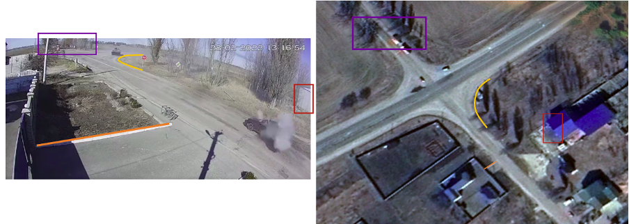
Figure 2: Geolocation of CCTV footage showing a civilian vehicle being targeted in Makariv.
The car is seen driving west towards an intersection as tanks arrive from the North. The Russian BMP-2 amphibious infantry fighting vehicle was shooting towards the car three times.
The first shot was fired while the Military vehicles were driving. Apparently, the first shell partially hit the car but did not cause widescale destruction. After the first hit, the car stayed static.
The next shot took place five seconds later. At that time, the first tank in the convoy already made it to the intersection. As the tank was 60 meters from the vehicle, he opened fire once again.
The shells directly hit the front part of the car. Footage from the scene shows a large explosion, followed by smoke billowing from the vehicle. Six seconds after the second shot, the BMP-2 fired a third time, causing another explosion and the car is seen completely destroyed.
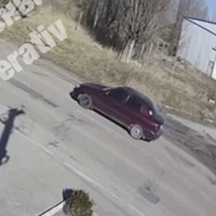
Figure 3: Sequence of events showing the civilian vehicle hit, causing multiple casualties.
In the background, the military convoy continues its journey and heads west at the intersection, followed by the BMP-2 that opened fire at the civilian vehicle.
An additional video posted later that day shows the remains of the vehicle and its passengers. There were two people in the car: an elderly man and a woman.
Further footage also shows a clear indication of a handicap sticker on the front of the car.
On 10 March, Kyiv Oblast police announced the death of a couple in their seventies as a result of this event.
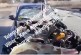
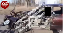
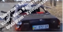
Figure 4: Images of the destroyed civilian vehicle.
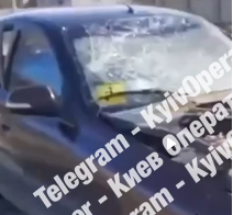
Figure 5: An Image of the destroyed vehicle, and a clear indication of a disabled user sign on the front of the car.
● Shelling of a bread factory (Geolocated to 50.453453, 29.813110)
On 7 March, the Kyiv Oblast police reported that an airstrike on Makariv had impacted a bread factory in town.
Using the images provided, EoR investigators were able to visually confirm the location of the bakery. The police reported that 13 civilians were killed and five more were injured.
Drone footage posted on 5 April showed damage to multiple buildings in the facility, some of them were severely damaged.
Residential and commercial buildings across the street were damaged as well, though it is not clear if it was due to the same attack.
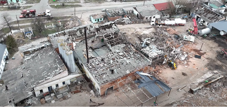
Figure 6: A screenshot of drone footage showing the damage to the bread factory.
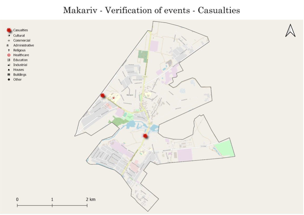
Figure 7: A map showing all civilian casualties resulting from Russian shelling in Makariv.
Damaged Civilian Infrastructure
Healthcare
● Damage to a private clinic (Geolocated to 50.460134, 29.8141980)
On 12 March, images were posted showing the destruction of several buildings in Makariv, including a medical clinic.
Two of the images showed the damage to the private clinic of “Adonis” on Bankivska street.
Footage showed fire rising from the roof of the clinic and significant damage to the building’s front, suggesting that it suffered a direct hit.
A YouTube video that was uploaded on 1 April shows the aftermath of the attack. The clinic was severely damaged, while nearby buildings were completely destroyed.
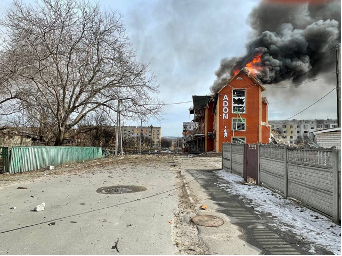
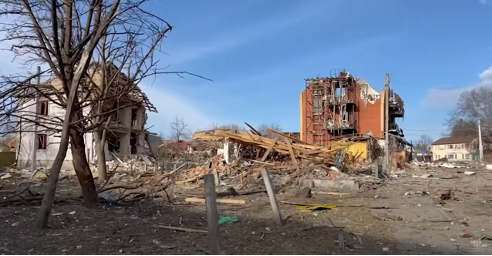
Figure 8: Footage from the aftermath of the attack on ‘Adonis,’ a private clinic in Makariv.
● Damage to a hospital (Geolocated to 50.463231 29.800146)
On 24 March, a video was posted on Twitter, revealing damage to civilian structures, as well as ambulances and private vehicles. Geolocation of the footage suggested it was taken near Makariv’s hospital.
EoR investigators were able to confirm the claims and geolocated the video to the entrance of the emergency department of the hospital.
On 22 March, a Facebook post by Makariv’s town council asked citizens to provide vehicles suited for carrying patients, claiming that their transportation vehicles were hit during a shelling earlier that day.
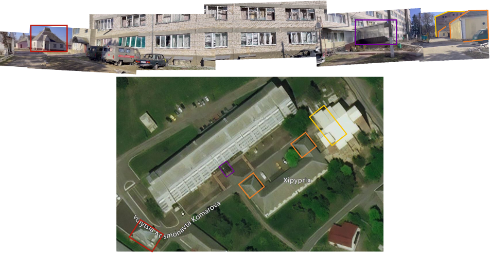
Figure 9: Geolocation of footage showing damage to Makariv’s Hospital.
Many windows of the main hospital building appear broken, and shrapnel damage to the building is visible as well.
Shrapnel damage is seen on one of the walls of the surgical buildings across the road.
An additional building has a crater in its roof, as well as shrapnel damage on the external wall. Seven vehicles have also appeared to sustain damage. At least three of them were ambulances.
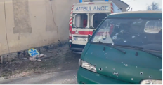
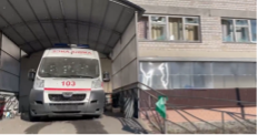
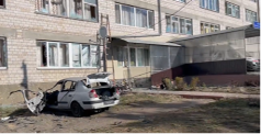
Figure 10: Footage showing the aftermath of the destroyed hospital in Makariv.
Footage from the scene also shows a crater with a tail fin. EoR investigators believe the crater was caused by OF-843B, a high explosive 120mm mortar round used by the Russian army.
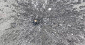
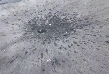
Figure 11: Footage showing the crater caused by the explosion.
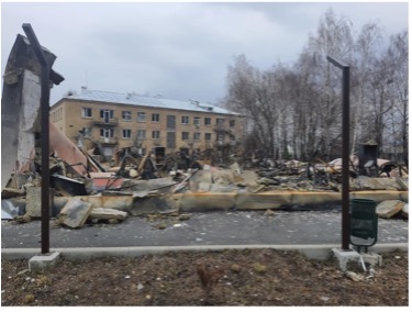
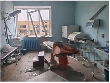
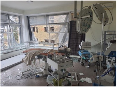
Figure 12: Footage showing the destruction of an outpatient clinic and eastern rooms in Makariv’s hospital.
Images posted by Ukraine’s health minister on 5 April showed that an outpatient clinic was completely destroyed at the Hospital premises.
Additional images showed damage to treatment rooms in the eastern section of the hospital.
On 18 April, Makariv Town Council announced on their Facebook page that several sections of the hospital were reopened.
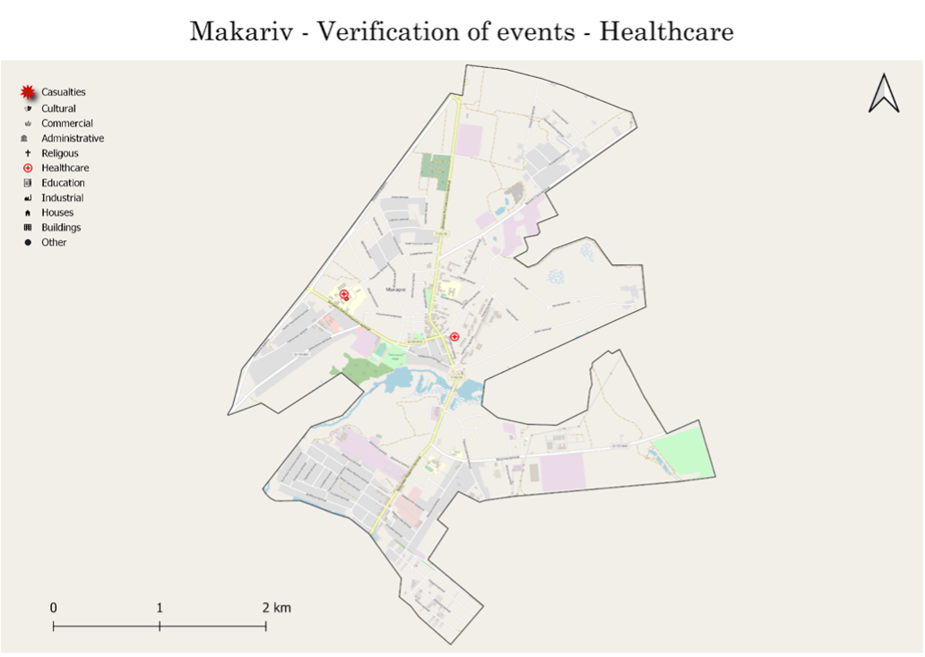
Figure 13: A map showing all verified incidents to healthcare facilities in Makariv.
Schools
● Damage to a kindergarten (Geolocated to: 50.449980, 29.814623)
An image posted on 19 April shows damage to “Barvinok” kindergarten on Vatutina street.
According to the article, eyewitnesses reported that the bombing of the kindergarten took place during the early morning hours of 7 March, the same time as the reported attack on the bread factory.
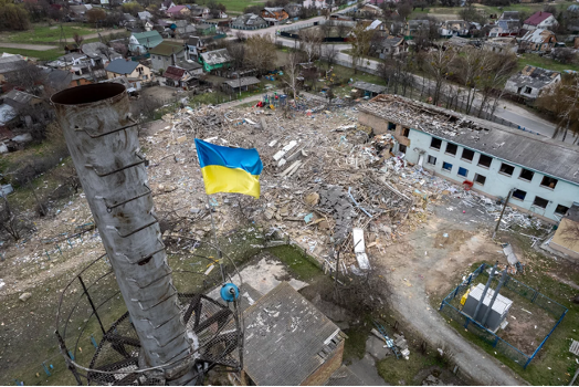
Figure 14: Footage showing the destruction of Barvinok kindergarten.
● Damage to a kindergarten (Geolocated to 50.460869, 29.816152)
An image posted on 12 March showed destruction to an educational facility. It is not clear when the image was taken but EoR investigators believe that it was on the same day as the strike.
Following a suggested geolocation posted on Twitter, EoR investigators were able to confirm that it shows a destroyed kindergarten, “ЗДО Теремок”, in Makariv.
Additional images were posted on 12 April, revealing the extent of the damage.
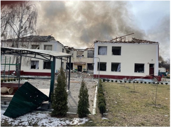
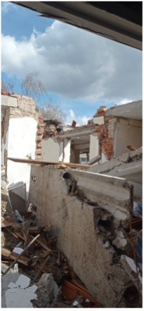
Figure 15: Footage showing the destruction of “ЗДО Теремок”, kindergarten in Makariv.
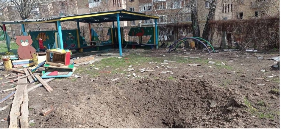
Figure 16: Footage showing a crater in “ЗДО Теремок”, kindergarten in Makariv.
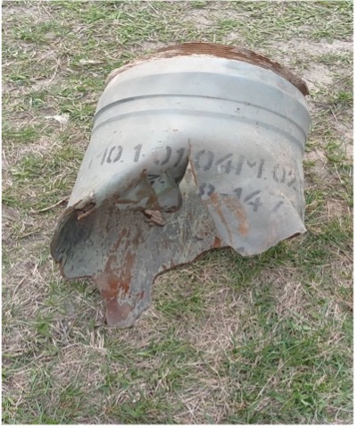
Figure 17: Footage showing the remains of a 300mm 9M55K rocket.
One image seemingly revealed the remains of a 300mm 9M55K rocket launched from a Smerch MLRS. Two more education facilities were damaged. The extent and time of the attack were not clear.
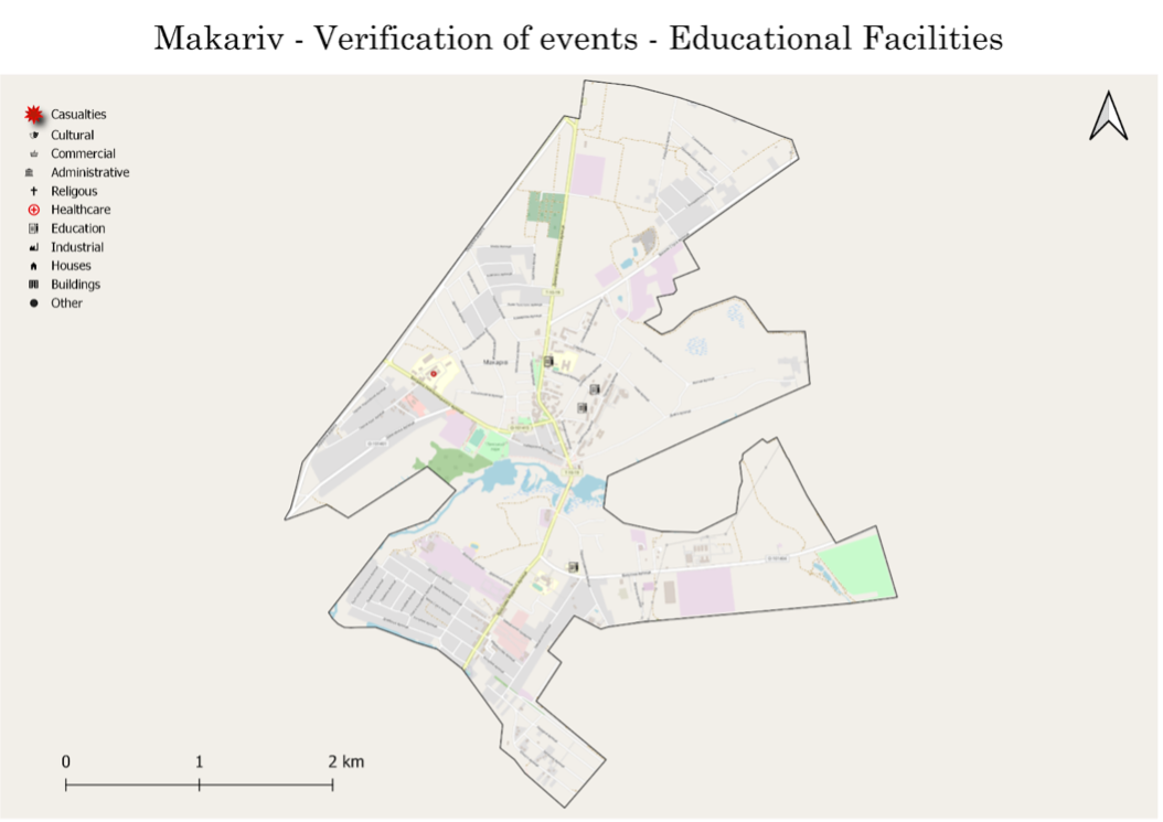
Figure 18: A map showing damaged educational facilities in Makariv.
Residential housing
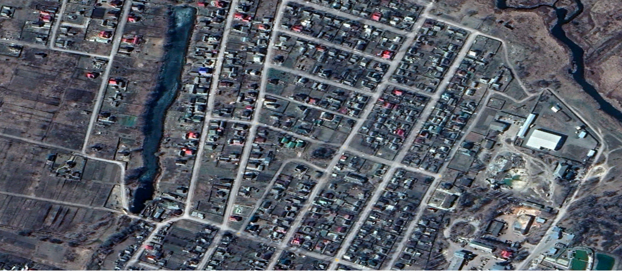
Based on publicly available drone footage from Makariv, EoR investigators were able to count 328 houses and 282 apartments that were damaged following Russian shelling.
Some of the properties were completely destroyed, and others were partially damaged.
For apartment buildings, EoR investigators included all the apartments in a building with visible destruction, as the damage to each apartment cannot be determined.
The actual figures are higher as our report is based on limited open-source data.
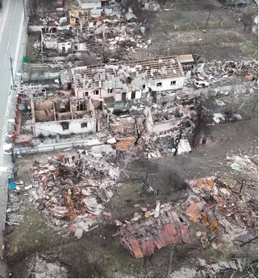
Figure 19: A Screenshot of drone footage showing the destruction of residential buildings.
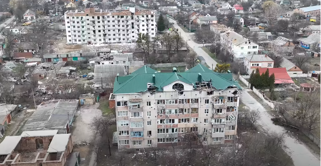
Figure 20: A Screenshot of drone footage showing the destruction of apartment buildings.
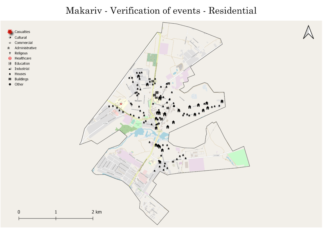
Figure 21: A map showing damaged residential buildings in Makariv. The size of the house represents the number of damaged properties in close proximity to one another.
Commercial and Industrial
Similarly to residential infrastructure, EoR investigators were able to count 32 commercial properties with visible damage from open-source footage.
A hotel, a market and pharmacies were among the damaged properties. In addition, EoR investigators noted damage to at least 21 industrial properties.
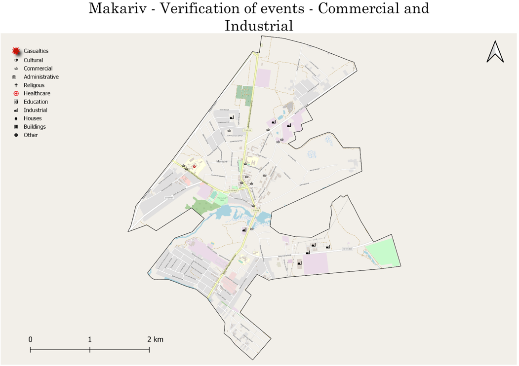
Figure 22: A map showing damaged commercial and industrial buildings in Makariv.
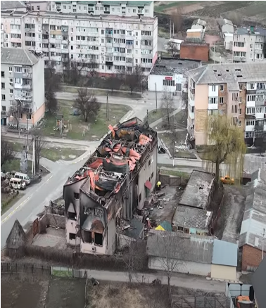
Figure 23: A screenshot of drone footage showing widescale damage to commercial properties in Makariv.
EoR investigators have also observed widespread damage to numerous facilities including the town hall, fire department, police stations, social security facility and a cultural centre.
Footage from multiple sources showed Makariv’s residents burying the dead in their backyard. They claimed that it is too dangerous to arrive at the cemetery.
A photo posted on Makariv’s town council’s Facebook page showed damage to the town’s cemetery.
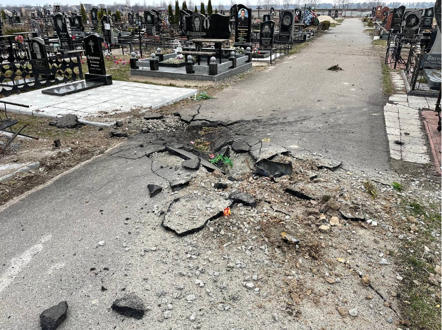
Figure 24: Footage showing damage to Makariv’s cemetery.