

Graphic content warning: This report contains potentially distressing images including images of bodies of deceased civilians (censored) and damage to residential housing.
The Map of Fires in Sudan is an effort of Sudan Witness to provide a visual display of data the project collected and verified on villages targeted with fire in Sudan, primarily the Darfur region.
Sudan Witness was established in April 2023 by the Centre for Information Resilience (CIR) in response to the outbreak of armed conflict within Sudan. Since then, Sudan Witness has been tracking where and when villages have been damaged by fire, specifically in the Darfur region, where there are repeated reports of attacks that could amount to crimes against humanity and violence that could develop into renewed campaigns of ethnic cleansing.
Analysis by Sudan Witness shows that at least 68 villages were damaged by fire in the six months between 15 April and 15 October 2023, some more than once. Some villages almost fully burnt down, while others were damaged on a smaller scale.
This article explains the interactive map created by Sudan Witness to document villages damaged by fire in Sudan and the methodology behind the documentation, including case studies of fire events in El Geneina (West Darfur) and Sekali (South Darfur).
Contents
Methodology on the verification of burnt villages in Sudan
Data Collection: NASA FIRMS, Reports and User-Generated content
Verification – Satellite Imagery Analysis
Limitations and False Positives
Case Study: El Geneina, 8 June 2023
Step 3: Assigning a Confidence Level
Case Study: Sekali, 29 April 2023
Step 3: Assigning a Confidence Level
Map of Fires in Sudan
Sudan Witness launched an interactive map that allows viewers to navigate the data collected and verified by the project. Each point on the map represents a fire event: a fire that happened on a specific day, or several consecutive days, in a specific area.
Viewers can explore the map by panning across different locations in Sudan and zooming in and out. Viewers can use the legend’s filter function to only view information of interest, and select different data layers and views, such as satellite view. To learn more about a specific event, viewers can click fire events on the map to open a pop-up window with more information, including links to relevant satellite imagery, media and other information.

Figure 1: The Map of Fires in Sudan allows panning, zooming, filtering and clicking on fire events to view detailed information about the event.
The map uses a tiered approach to the verification of villages damaged by fire. A more detailed breakdown of the verification can be seen further down in this methodology.

Minimum requirements for confidence levels. The bottom row shows the chronolocation margins for the different confidence levels.. Exceptions to these margins are added to public notes.
Methodology on the verification of burnt villages in Sudan
Sudan Witness relies on an array of tools and techniques to identify, verify and report on burnt villages. The project utilises multiple formats of data to verify where, when and – in a number of cases – what happened on the day of the alleged fire event. This includes geospatial data on thermal anomalies from NASA, satellite imagery, media reports and photo and video footage taken on the ground and posted to social media.
This section briefly outlines the practical steps taken to verify fires in Sudan. The next section explains each step in more detail.
Data Collection: NASA FIRMS, Reports and User-Generated Content
Sudan Witness monitors three types of resources to collect fire claims: traditional and social media for reports on fires, user-generated content and satellite data. This includes data from NASA’s Fire Information for Resource Management Systems (FIRMS)*, a satellite monitoring tool that provides near-real-time information on locations with heat anomalies.
After collecting claims or allegations of fires, Sudan Witness investigators conduct further open-source investigations and proceed with the verification process.
*NASA FIRMS stands for National Aeronautics and Space Administration Fire Information for Resource Management System. A further explanation of FIRMS follows under ‘How Sudan Witness identifies, verifies and reports on fires’.
Verification: Geolocation and Satellite Imagery Analysis
The next step of the investigation and verification process involves analysis of satellite imagery, and potentially includes geolocation.
Satellite imagery can be used to search an area of interest, helping to:
Identify whether plumes of smoke or active fires are visible on the dates of a claimed fire incident, or on the dates that NASA FIRMS detected heat anomalies.
Compare imagery captured before and after a potential incident to assess whether fire damage or burn scars were detected.
If fires are identified in user-generated content posted on social media, geolocation techniques can be used as an alternative way to verify their location. Geolocation is a process used to determine the exact location where a photo or video was taken or recorded.
While the verification process usually includes all of the elements above, the order of these steps can vary greatly. For example, instead of identifying potential fires on NASA FIRMS first, Sudan Witness investigators may first identify claims based on witness reports or user-generated content on social media. Investigators would then geolocate and verify that content, before finally using FIRMS to identify whether any heat anomalies were detected on the claimed dates.
Limitations and False Positives
This methodology has several limitations, including uncertainty regarding the cause of fires, gaps and errors in data, such as weather conditions that prevent fire detection by satellites, and challenges with interpreting satellite imagery.
To address these limitations, the team actively investigates the locations where heat anomalies or fire damage was observed to identify false positives, which are not included on the map. In addition, Sudan Witness actively seeks for corroborating data to help verify fire claims and assigns confidence levels to each incident.
Assigning a Confidence Level
Sudan Witness applies a five-tier classification system to indicate the degree to which events have been verified. After verification, an appropriate confidence level is assigned to each incident according to the degree of verification Sudan Witness was able to achieve.
Data Collection: NASA FIRMS, Reports and User-Generated content
Sudan Witness uses three main types of resources to collect claims of fires in built-up areas in Sudan. First, investigators monitor traditional media and social media to collect reports of fires. Second, investigators collect and analyse user-generated content – that is, videos and images shared on different online platforms – to identify fires in residential areas. Finally, investigators collect imagery from satellite sources to identify potential fire damage, particularly the NASA Fire Information for Resource Management System (FIRMS).
NASA FIRMS is a free online tool originally created for monitoring wildfires that provides near-real-time locations of heat anomalies across the globe. Satellite sensors measure the strong emission of mid-infrared radiation from fires and report them back to the FIRMS website within just a few hours. FIRMS uses satellite constellations to detect temperature anomalies, including Moderate Resolution Imaging Spectroradiometer (MODIS) and the Visible Infrared Imaging Radiometer Suite (VIIRS). Figure 2 shows a screenshot of the town of Murnei on the FIRMS website, with 28 and 29 May 2023 selected on the timeline, both days on which heat anomalies were detected in the town. Sudan Witness verified fire events in Murnei on these days with a high level of confidence.

Figure 2: FIRMS screenshot of the city of Murnei, West Darfur, with 28 and 29 June 2023 selected on the timeline. VIIRS hotspots were detected in different areas of the city on both days. (Source: NASA FIRMS / Annotation by Sudan Witness)
FIRMS is a valuable tool for identifying potential burnt villages. However, because FIRMS detects all sources emitting heat, and cannot determine the cause of the heat, further verification is required to assess whether the source is a village fire. Sudan Witness investigators must verify which anomalies are false positives, such as heat from active industry, waste burning and other unrelated events which output an infrared heat signature.
In addition, FIRMS’ accuracy can be impacted by a number of factors, such as the spatial resolution of the sensor, or pixel size, or ground displacement. Additionally, environmental factors such as strong cloud coverage can interfere with the accuracy of FIRMS’ reporting. These observations underline the importance of the verification process.
By monitoring these resources, Sudan Witness is able to identify incidents where a village may have been damaged by fire. Investigators will then identify the names of the locality or localities, and conduct further open-source investigations to look for supporting information. This is done by searching traditional media and social media to collect information and user-generated content. After information collection is complete, the next step is verification.
Verification – Geolocation
Verification is typically done using satellite imagery and geolocation techniques. Geolocation is a technique to determine the exact location where a photo or video was taken or recorded, often using satellite imagery to cross-reference geographic details, visual features or landmarks in video footage or images. A high burden of proof is required to match imagery.
If fires or smoke plumes are identified in footage, geolocation techniques can be used to identify the location of the fire event. An example is shown in figure 3, which shows a geolocation of a video in which plumes of smoke are seen in Murnei, West Darfur. Fires in Murnei occurred on 27 June 2023 and subsequent days, and videos and images started to appear online weeks after.
Sudan Witness investigators collected these pieces of footage to create a stitched panorama from a TikTok video. This was juxtaposed with satellite imagery from Google Earth/Airbus, to mark landmarks in both images to confirm the location.

Figure 3: Geolocation of a video by comparison of satellite imagery and a stitched panorama created from still images of a video filmed on a hill south from Murnei, during the attack on the city. The video was most likely filmed on 27 June [12.938491, 22.88339]. (Source: TikTok (below) / Airbus (top) / Annotation by Sudan Witness)
Just as the location of an event can often be verified using geolocation techniques, the date and time of events can sometimes be verified using chronolocation techniques, that is the determination of the exact date and time footage was recorded. However, not all footage subject to investigation contains enough information to be chronolocated. Sudan Witness investigators corroborate geolocation and chronolocation techniques with NASA FIRMS and satellite imagery analysis to increase the confidence level of when a fire has happened.
Verification – Satellite Imagery Analysis
Analysis of satellite imagery can be used to confirm the location and the timing of fire events, often within a range of a couple of days. For this analysis, Sudan Witness utilises various publicly available resources for satellite imagery and multispectral imagery, as well as imagery captured by commercial providers.
Resolution and multispectral banding
High-resolution imagery, low-resolution imagery and multispectral imagery are all useful for the verification process. Low-resolution imagery does not provide the same level of detail as high-resolution imagery, but is often freely available and more frequently updated. Copernicus Sentinel-2 for example, is usually updated every five days, and also has multispectral imagery available.
Multispectral imagery is captured with not only visible light, but also with different regions or ‘bands’ of the electromagnetic spectrum, or specific wavelengths, such as infrared. These images require a higher level of interpretation as they look different from ‘true colour’ images, but provide information normally not visible to the human eye. Compositing these bands creates filters such as False Colour Composite (FCC), which is highly useful for the detection of fire and fire damage.
The value of multispectral imagery is demonstrated with a mosaic of Sentinel-2 images in figure 4, captured within a 10-day period of a village about 35 kilometres east from Nyala. The top row displays images in ‘true colour’, as humans would see it naturally. The centre row shows multispectral ‘false colour’ imagery, which can help to identify the fire in the centre image. The images in the bottom row of figure 4 are processed with a custom script which contrasts fires even more clearly, uncovering a red and yellow shade in the 26 April image (bottom right in figure 4), which in this case most likely displays a smouldering fire.

Figure 4: Mosaic of Sentinel-2 images captured of a village [12.080118,25.20252] about 35 kilometres east from Nyala, on 16 April (left), 21 April (centre) and 26 April 2023 (right). The images are processed with true colour (top), false colour (centre), and a custom script based on a False Colour filter (bottom).
(Source: Copernicus Sentinel-2, processed with EO Browser)
Active fires and smoke plumes
Satellite imagery can be analysed for visible plumes of smoke in a given area, as shown in figure 4, as well as figure 5. The comparison in figure 5 made with high-resolution imagery from commercial provider Planet shows central Murnei on 13 June and 30 June 2023. Active fires and plumes of smoke are visible in the image captured 30 June, in the same area where NASA FIRMS detected heat anomalies that day.
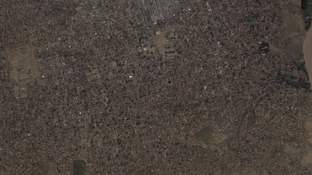
Figure 5: Comparison of satellite imagery captured of Murnei on 13 June and 30 June 2023. Active fires with smoke plumes are visible in the second image [12.947549,22.873390]. (Source: Planet Labs PBC)
Copernicus Sentinel-2 low-resolution imagery allows for the processing of imagery with different filters and scripts, such as the wildfires script that was specifically developed for the analysis of active fires (figure 6). Processing imagery with filters and scripts makes it easier to detect and analyse active fires and fire damage.

Figure 6: Sentinel-2 image captured of El Geneina on 14 May 2023, processed with the wildfires script created by Pierre Markuse. The image is a composite of different bands processed with an algorithm to highlight active fires.(Source: Copernicus Sentinel Hub, processed with EO Browser / Annotation by Sudan Witness)
Comparing before and after images
Imagery captured on the exact day and time of the fire event is not always available, and weather conditions can prevent analysis. In these cases, side-by-side comparison of imagery captured before and after a potential fire event can be used for verification. Figure 7 demonstrates how such a comparison is utilised to detect fire damage. The figure shows a village located about 5 kilometres southwest from Kubum, a town in South Darfur. In the second image, the smaller or missing prints of trees and the missing glare from rooftops throughout the village confirm the fire damage. This corroborates with data from NASA FIRMS, which detected fires on a date in between the capture dates of these images.
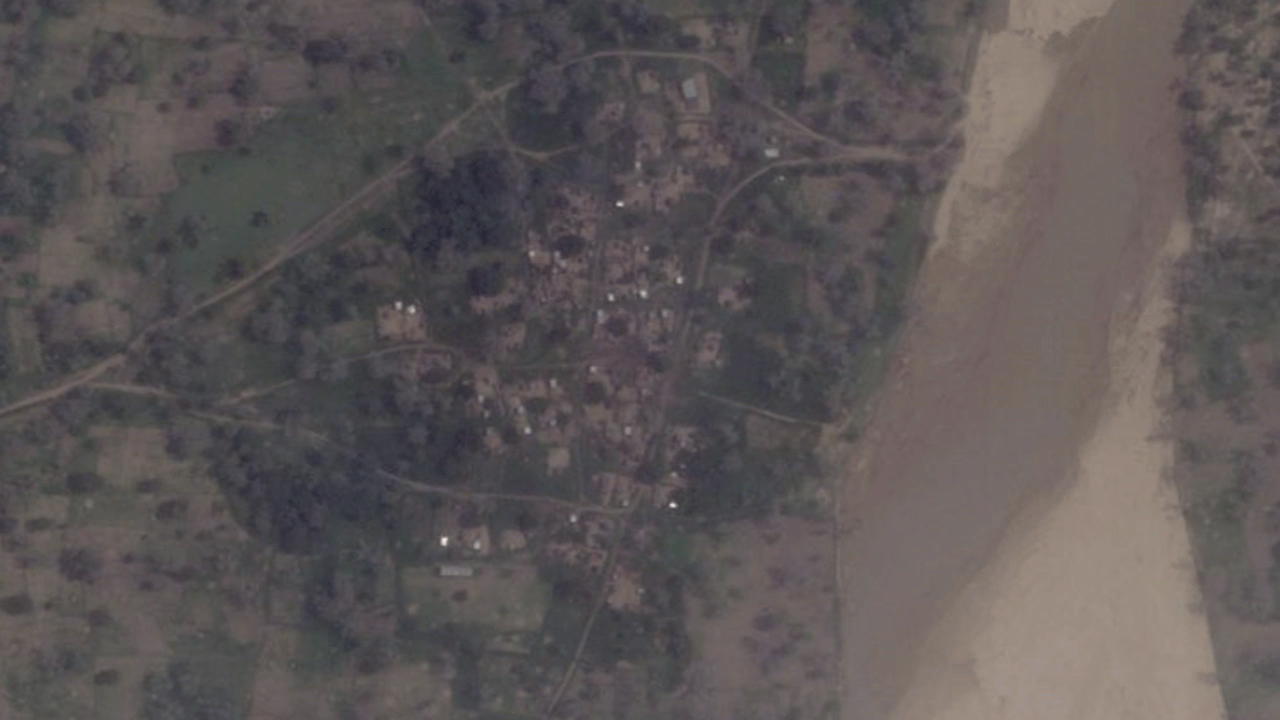
Figure 7: Comparison of satellite images of a village about 5 kilometres southwest from Kubum [11.720649,23.779173], captured on 11 August and 28 August. NASA FIRMS detected fires in this village on 16 August.
(Source: Planet Labs PBC)
Copernicus Sentinel-2 is another well-suited tool for comparing before and after images due to its five-day revisit time and multispectral imagery. The centre row in figure 4 for example displays false colour images that show vegetation in red, and yellowish ground. Burn scars often exhibit a greater contrast in false colour imagery, which can help to identify whether certain areas were burned. This is shown in the centre row of figure 4, where there is a visible darker brownish part in the village in the image on the right to the image on the left.
Another example of a filter useful for before and after analysis to detect burn scars in an area of interest is Short Wave Infrared Composite (SWIR). SWIR can be used to estimate the amount of water present in plants and soil, but also to detect fire damage, as recently burnt areas reflect strongly in SWIR.
Figure 8 shows an example of this reflection, visible as brownish spots in a village called Wustani (in the centre). Sudan Witness geolocated a video that was posted to Facebook, showing a burning village to this village. However, NASA FIRMS only detected heat anomalies in surrounding villages, on 16 August 2023. The comparison with SWIR imagery made it likely that the fires identified in footage filmed at the village also occurred on the 16th.
Figure 8: Sentinel-2 imagery comparison of images captured of Wustani [11.734253, 23.583400], a small village in Central Darfur, about 20 kilometres west from the town Kubum. (Source: Copernicus Sentinel-2, processed with EO Browser)
Limitations and False Positives
There are several limitations to the methodology outlined above. These include uncertainty regarding the cause of fires, gaps and errors in data, such as weather conditions that prevent fire detection by satellites, and challenges with interpreting satellite imagery. To address these limitations, Sudan Witness actively investigates the locations of verified fire events and heat anomalies detected by NASA FIRMS to identify false positives, cross-references and makes the most of different resources to mitigate data gaps. In addition, the project assigns confidence levels to reported fire events to reflect the extent to which verification was possible.
The main methodological challenge faced by Sudan Witness in verifying villages damaged by fire is the uncertainty regarding the cause of a fire. While some fires may be intentionally lit to cause damage to villages, others may be accidental, the result of natural or industrial causes, part of an organised waste burning, or the result of other combat events such as shelling. To minimise false positives, or fires deemed irrelevant for this analysis, Sudan Witness maintains situational awareness by monitoring a variety of international and regional media, social media and other sources. Investigators also verify the exact locations of events to rule out other explanations.
One example of an event evaluated as irrelevant is a fire that occurred on 8 September 2023 in the outskirts of Haskanita, a town in East Darfur. The only burn scars visible in post-event satellite imagery at the location where NASA FIRMS detected the fire were located in several adjacent compounds at the southern outskirts of the town. Further analysis showed the scars to resemble waste burning pits, which are common in the outskirts of villages in Sudan. Earlier dated satellite imagery reveals scorch marks present at these compounds before the event (figure 9), as early as October 2019 (figure 9, left). Using FIRMS’ archive, a pattern of heat anomalies at this location is identified; fires were not only detected on 8 September 2023, but also one year before on 2 September 2022 (figure 10, left), and in August 2021 as well.

Figure 9: Waste burn pits at the outskirts of Haskanita [11.950930,26.630504], East Darfur.
(Source: CNES/Airbus / Annotation by Sudan Witness)

Figure 10: FIRMS heat anomalies in Haskanita [11.950930,26.630504], East Darfur, on 8 September 2023 (right) and the same period in 2022 (left).
(Source: / Annotation by Sudan Witness)
Sudan Witness classified this event as a false positive. False positives do not appear on the map, but are kept in a separate database in case new data surfaces that warrants additional investigation.
In cases where Sudan Witness does not have enough data to verify the relevance of a fire event, a public note is added to the fire event on the map. These notes are visible in a pop-up window that appears after users click on a fire event on the map. For example, in cases where little damage is observed post-event and reports of combat in the same period exist at the same time, a note reading ‘possibly combat related’ is added to the fire event.
A second methodological challenge concerns limitations and errors in the available data. Weather conditions can prevent fire detection, or interfere with satellite analysis. Further, settlements in Darfur are not always visible on maps, and some do not have official names, which makes searching for them difficult. Such limitations make it difficult to create a full picture. To overcome some of these challenges, investigators at Sudan Witness make the most of other resources where possible. For example, Sentinel-2 imagery is used for the detection of fires as well as NASA FIRMS, and different resources are used to map settlements.
A third methodological challenge concerns the level of expertise required to analyse and interpret satellite imagery. Challenges include distinguishing fires from rooftop glare or material emitting heat and comparing imagery captured with different satellite angles at different times of day. Not all fire damage is visible in satellite imagery, and changes in land or buildings may look similar to burn scars while being something else entirely. Analysis of multispectral imagery requires knowledge and experience as well.
Assigning a Confidence Level
To reflect some of these limitations, Sudan Witness applies a five-tier classification system to indicate the degree to which events have been verified (figure 11). If active fires are observed in satellite imagery or in verified footage, and burn scars are visible on post-event satellite imagery, a ‘very high’ confidence level is assigned and the fire event appears as a dark red point on the map.
If only NASA FIRMS detected heat anomalies in a village and no damage was observed in post-event imagery, the ‘unconfirmed’ label is assigned until new information surfaces that requires an update to the confidence level. Figure 11 shows the minimum requirements for every confidence level.
Figure 11: Minimum requirements for confidence levels. The bottom row shows the chronolocation margins for the different confidence levels. Exceptions to these margins are added to public notes.
Very high confidence: Active fires or smoke plumes were identified in satellite imagery or in verified user-generated content. Post-event burn scars were also identified on satellite imagery.
High confidence: Post-event burn scars were identified on satellite imagery in an area where NASA FIRMS* detected heat anomalies.
Medium confidence: Post-event burn scars were identified on satellite imagery, or active fires were identified in verified user-generated content, but no heat anomalies were detected with NASA FIRMS. Chronolocation margin can be greater than 5 days.
Low confidence: Post-event scars which may be fire damage were identified on satellite imagery where NASA FIRMS detected heat anomalies or signs of fire were detected with low resolution satellite imagery.
Unconfirmed: Scars which may be fire damage were identified on satellite imagery, or NASA FIRMS detected heat anomalies in the area.
The date of the fire event displayed on the map is always the date assessed to be the most likely first day of the event, which is often the first day that NASA FIRMS detected heat anomalies. If FIRMS data are unavailable, the date is often derived from before and after comparison of satellite imagery and usually has a margin of up to five days (see the bottom row of figure 12). Details on the exact chronolocation margin and the method used for the chronolocation of the event are included in a pop-up window which appears when users click on the event point on the map.
Case Study: El Geneina, 8 June 2023
El Geneina, the capital of West Darfur, was damaged by fires in the weeks after 15 April 2023. The first fires were detected 10 days afterwards, on 25 April 2023. Sudan Witness identified multiple fire events in El Geneina in the period thereafter, including an event on 8 June 2023.
Step 1: Data Collection
NASA FIRMS satellites with VIIRS sensors detected three heat anomalies on 8 June 2023, all in the hours after 12:00 noon (local time). Figure 12 shows these heat anomalies (represented by red squares) in El Geneina in FIRMS.

Figure 12: Screenshot taken from FIRMS, showing heat anomalies in a residential area of El Geneina. (Source: NASA FIRMS and Maptiler/OpenStreetMap contributors / Annotation by Sudan Witness)
Sudan Witness collected several videos circulating on social media in the days after 8 June 2023, allegedly depicting recent events in the city. In one of these videos, an armed man is seen walking away from a burning house, with dead bodies in the streets and smoke rising over the city in the background (figure 13).

Figure 13: Stitched panorama created by Sudan Witness using video stills from footage claimed to be filmed in El Geneina [13.4297,22.4526]. The video circulated online, two days after NASA FIRMS detected heat anomalies. Flames are seen coming out of a dwelling in the top right.
Dead bodies in the streets have been censored. (Source: [Warning: graphic content displaying dead bodies] X (formerly Twitter) / Annotation by Sudan Witness)
Step 2: Verification
Cloudy weather prevents analysis of satellite imagery captured that day. However, analysis of before and after low-resolution multispectral imagery captured before and after 8 June 2023 shows new burn scars in the same area where heat anomalies were detected by NASA FIRMS (figure 14).
Brownish burn scars are present in both images (taken before and after the alleged fires) along the main road that runs from east to west, as is seen in a side-by-side comparison. However, newly brownish spots appear south of the road in the image captured post-event (image on the right in figure 14).

Figure 14: Comparison of Sentinel-2 imagery processed with a custom script based on the False Colour filter, showing new burn scars in a residential area in El Geneina [13.434,22.4264] on 13 June 2023 (right). (Source: Copernicus Sentinel Hub, processed with EO Browser / Annotation by Sudan Witness)
Sudan Witness was unable to find a version of the video from figure 13 uploaded before the date of the alleged fires, suggesting that the video may have been filmed in the same area where burn scars were observed. This insight and further analysis of the footage by Sudan Witness were used to geolocate the video to the neighbourhood south from the main road where fire damage was observed (figure 15A and 15B).

Figure 15A: Geolocation of the video in which a burning dwelling is seen. Visual features in the video are cross-referenced with satellite imagery to confirm the location [13.43297, 22.44701]. Dead bodies in the top image have been censored. (Source: [Warning: graphic content displaying dead bodies] X (formerly Twitter) / Airbus / Annotation by Sudan Witness) (Source: Copernicus Sentinel Hub, processed with EO Browser / Annotation by Sudan Witness)

Figure 15B: Supplementary verification to figure 16A, with another visual feature visible in the video from figure 14 cross-referenced with satellite imagery [13.43297, 22.44701]. (Source: [Warning: graphic content displaying dead bodies] X (formerly Twitter) / DigitalGlobe / Annotation by Sudan Witness)
In addition, high-resolution imagery of this particular area further supports the claim that fires occurred, as brownish spots and smaller prints from vegetation are visible in a before and after comparison of imagery (figure 16). This includes the location where the fires were visible in the video (figure 16, white box).
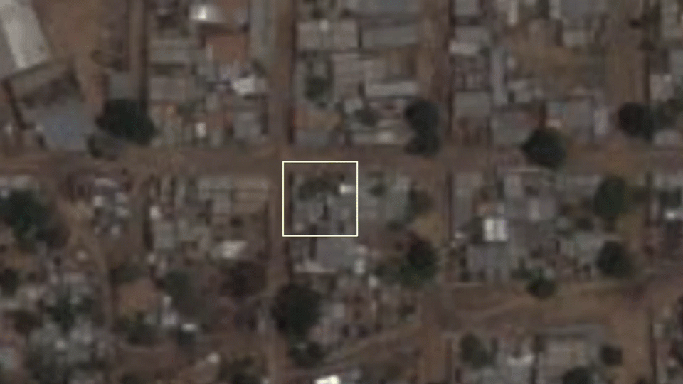
Figure 16: High-resolution satellite imagery comparison of images captured on 5 June and 29 June 2023, showing the geolocation of figure 15A/15B in the white box [13.43297, 22.44701]. The prints of vegetation in the white square are visible on 5 June and have almost entirely disappeared in the 29 June image.
(Source: Planet Labs PBC)
Step 3: Assigning a Confidence Level
The fact that NASA FIRMS detected heat anomalies in this residential area, and the absence of any reason to doubt the relevance of those heat anomalies, give a sufficient level of verification to add the event to the map. The burn scars visible on satellite imagery allowed Sudan Witness to assign a ‘High’ confidence level. The geolocated video showing fires added another level of verification, resulting in a ‘Very High’ confidence level for this fire event on the map.
Case Study: Sekali, 29 April 2023
Sudan Witness examined an area located northeast from Nyala, South Darfur, and verified that multiple villages were damaged by fire in April and May 2023. One village of particular concern is Sekali, located about 35 kilometres from Nyala.
Step 1: Data Collection
NASA FIRMS did not detect any heat anomalies in Sekali after 15 April 2023, and Sudan Witness did not identify active fires in satellite imagery. However, burn scars were observed in imagery captured on 1 May 2023 (figure 17).

Figure 17: False Colour imagery showing Sekali [12.3057478, 25.0783753] on 1 May 2023. Scarring that may amount to fire damage is visible in the village centre in the white box. (Source: Copernicus Sentinel Hub, processed with EO Browser / Annotation by Sudan Witness)
Step 2: Verification
Medium resolution satellite imagery from Planet showed similar scarring of the village on 29 April 2023. The damage was even clearer in a comparison of Sentinel-2 false colour imagery captured on 26 April and 6 May 2023 (figure 18).

Figure 18: Comparison of two False Colour images captured on 26 April and 6 May 2023, showing burn scars in Sekali [12.3057478, 25.0783753]. (Source: Copernicus Sentinel Hub, processed with EO Browser)
High-resolution imagery confirms that the scarring is fire damage. Google Earth regularly updates its satellite imagery in different regions, and provides a high-resolution image of Sekali captured on 4 May 2023, days after the first image on which Sudan Witness identified burn scars was taken. White spots, likely ash from the burning, are visible in the exact same area where the burn scars were identified (figure 19).

Figure 19: High-resolution satellite image of Sekali, captured on 4 May 2023. White spots, likely ash from the burning, are seen in the magnified cut-out [12.305514,25.076946]. (Source: Airbus / Annotation by Sudan Witness)
Step 3: Assigning a Confidence Level
For Sekali, the scarring on low-resolution imagery alone would warrant including the event on the map as an ‘unverified’ event. The fire damage visible in high-resolution imagery upgrades this assessment to a ‘Medium’ level of confidence, as the absence of burn scars on satellite imagery before May confirms that the event occurred after 15 April 2023. However, either NASA FIRMS data, satellite imagery showing active fires or verified footage showing fires or burn damage would be required to warrant a higher confidence level for event verification.
Sudan Witness is continuing to conduct open-source investigations to further identify, verify and report on village fires in Sudan. The methodology used by the project to do so remains dynamic, and responsive to new ways to counter limitations in data and improve the verification process. New findings will continue to be reflected in regular map updates.
You can access the Map of Fires in Sudan here.